
Orographic Construction of a Numerical Weather Prediction Spectral Model Based on ASTER Data and Its Application to Simulation of the Henan 20·7 Extreme Rainfall Event


Abstract
:1. Introduction
2. Materials and Methods
2.1. The Yin-He Global Spectrum Model
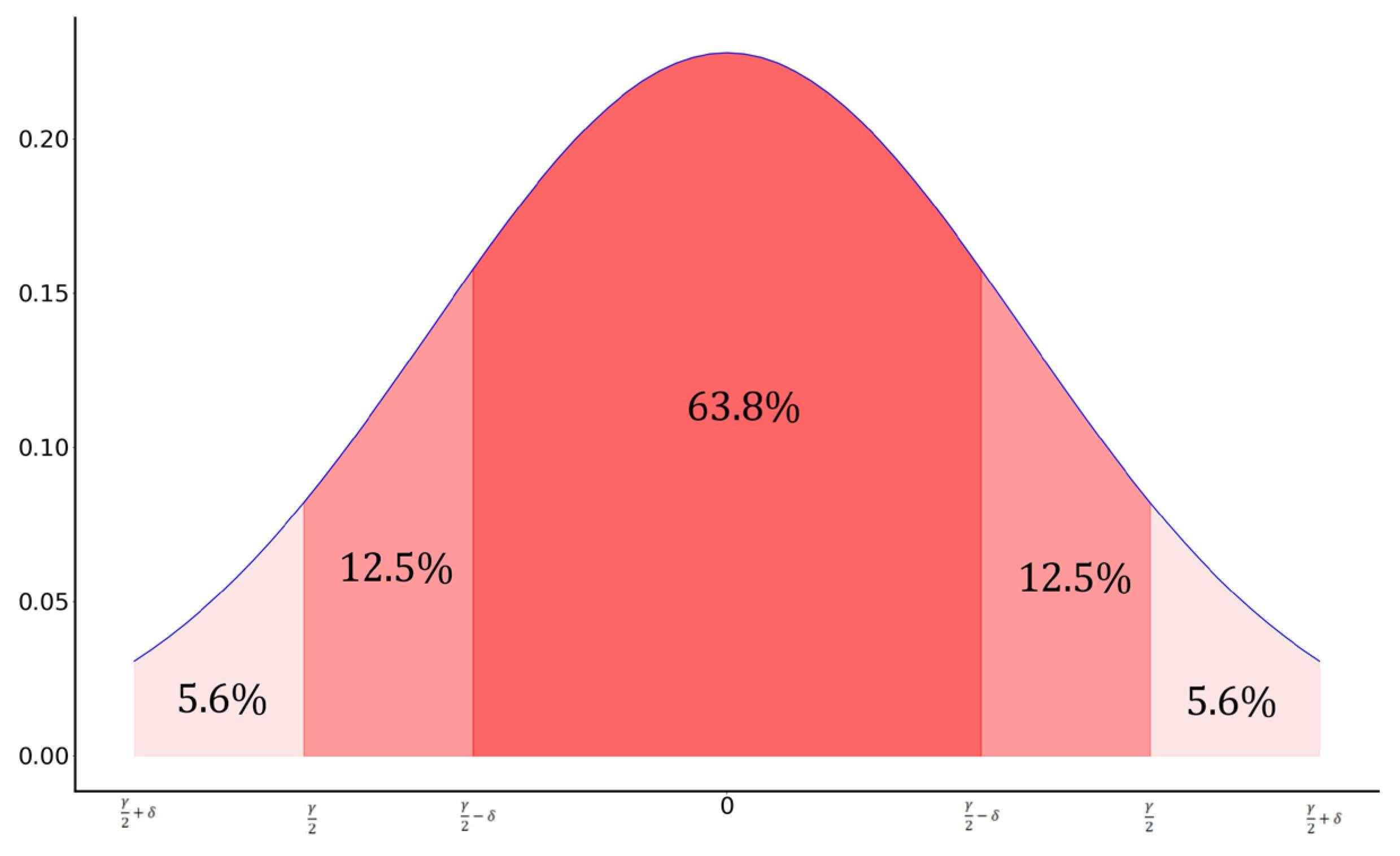
2.2. Orographic Data and Filter
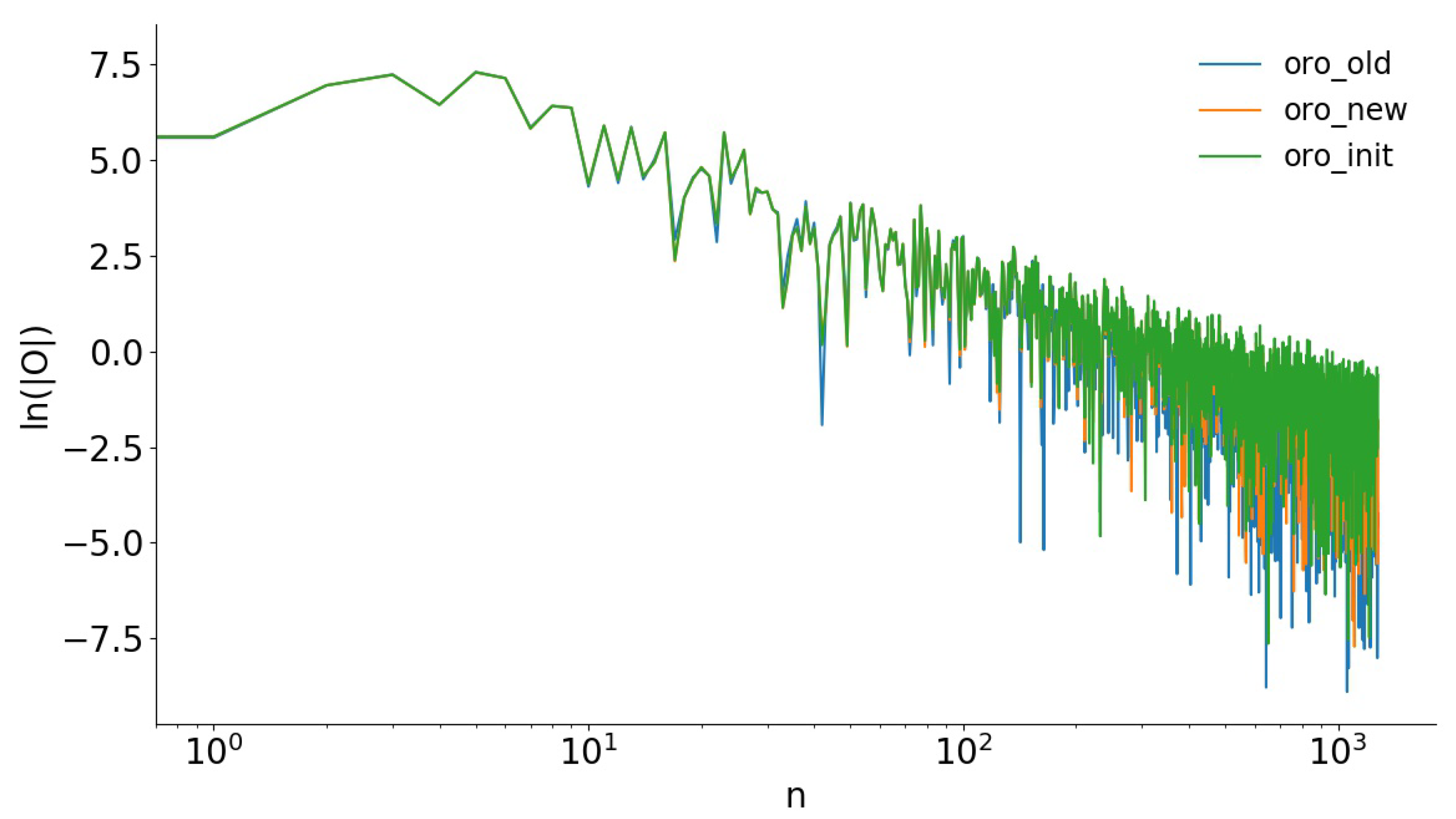
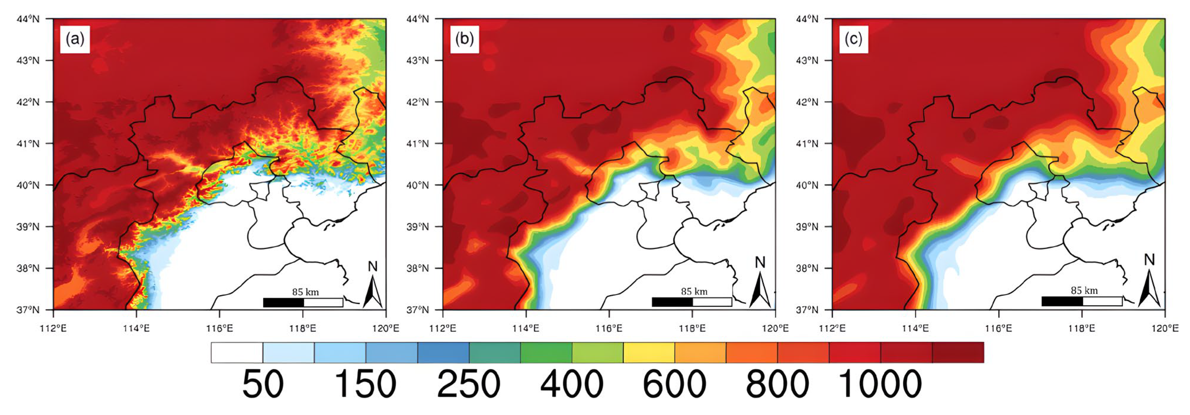
2.3. Processing Steps for Orographic Data
- (1)
- The first filtering is performed on the initial global orographic dataset with a resolution of 30′′. The filter scale is set to 5 km, and the edge scale is set to 1 km. The filter scale is set according to the requirements of the scale information to be filtered out. The edge scale affects the overall filtering effect. Therefore, it should not be set too large, generally to 1 km. The purpose of this step is to filter out the orographic features below the 5 km scale because, as described in Section 1, orographic features below the 5 km scale should be described in the TOFD parameterization scheme. These small-scale orographic information in the dynamics of patterns will not be conducive to NWP. It would be detrimental to NWP if these small-scale orographic features are retained in the model’s dynamics.
- (2)
- After the filtering operation in the first step, the orographic dataset is interpolated to a resolution of 2′30′′ (the grid spacing near the equator is about 5 km). The purpose of this step is mainly to prepare for the second filtering and to separate the different orographic scale information.
- (3)
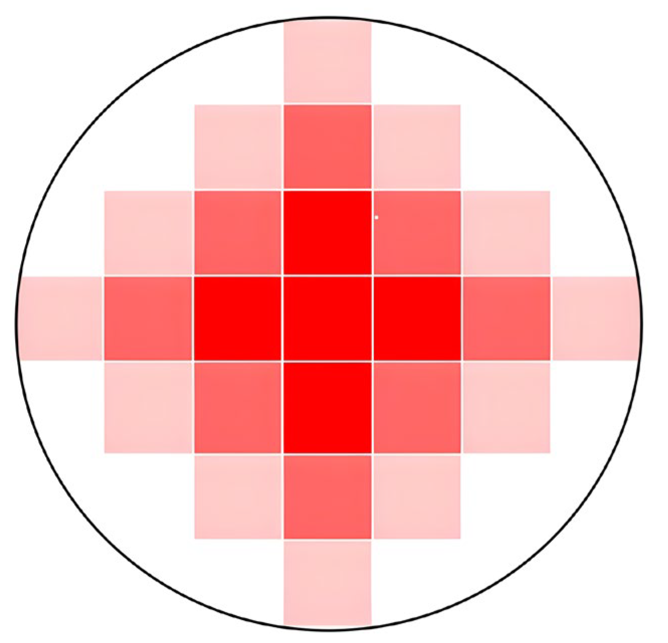
- The second filtering is carried out on the orographic dataset with a resolution of 2′30′′. The filter scale is set to 16 km, and the edge scale is set to 1 km. The purpose of this step is to filter out orographic features below 16 km because the resolution of YHGSM used in this study is T1279 (the grid spacing around the equator is about 16 km). Orographic features from 5 km to grid spacing (about 16 km) should be described in Sub-grid Scale Orography (SSO) parameterization schemes to optimize orographic effects in NWP models. When performing two-dimensional filtering in this step, the weights in Equation (3) need to be adjusted slightly to , , and due to the change in the grid distance.
- (4)
- After the filtering operation in the second step, the orographic dataset is interpolated from a 2′30′′ resolution to a 7′30′′ resolution (the grid spacing near the equator is about 16 km). The purpose of this step is mainly to prepare for the next second filtering and to separate the different orographic scale information. The purpose of this step is to get closer to the model’s resolution before performing the spectral transformation. However, the interpolation operation reduces the resolution of the orographic dataset, which means that some small-scale orographic features are lost. To discuss whether kee** higher resolution before spectral transformation is more beneficial to NWP, a switch is set in this step.
- (5)
- The grid orographic dataset is converted to spectral orography with a target resolution of T1279. Numerical weather prediction spectral models generally choose a spherical harmonic as the basis function. The spherical harmonic is as follows:
3. Results
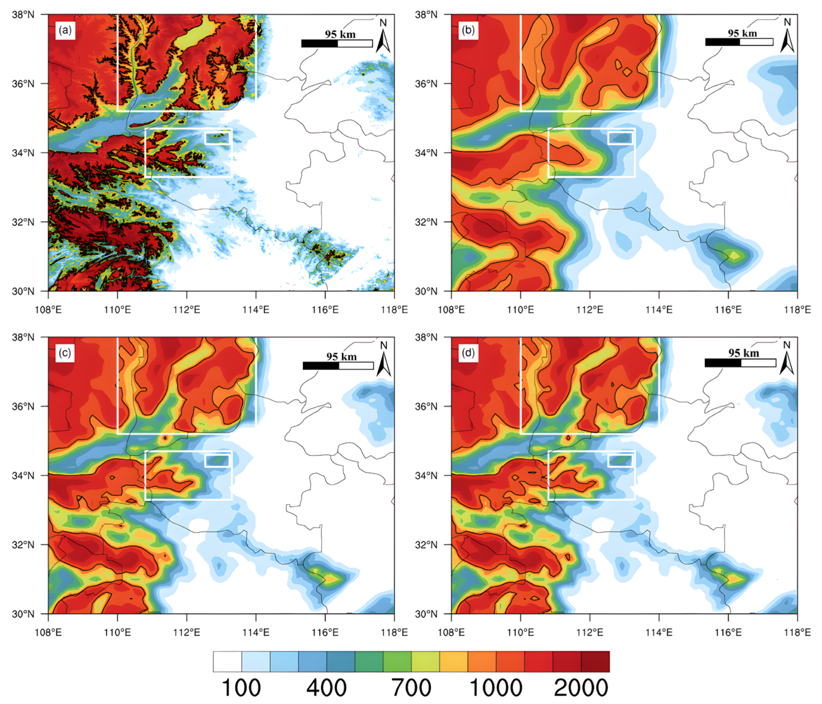
3.1. Overview of the Study Area
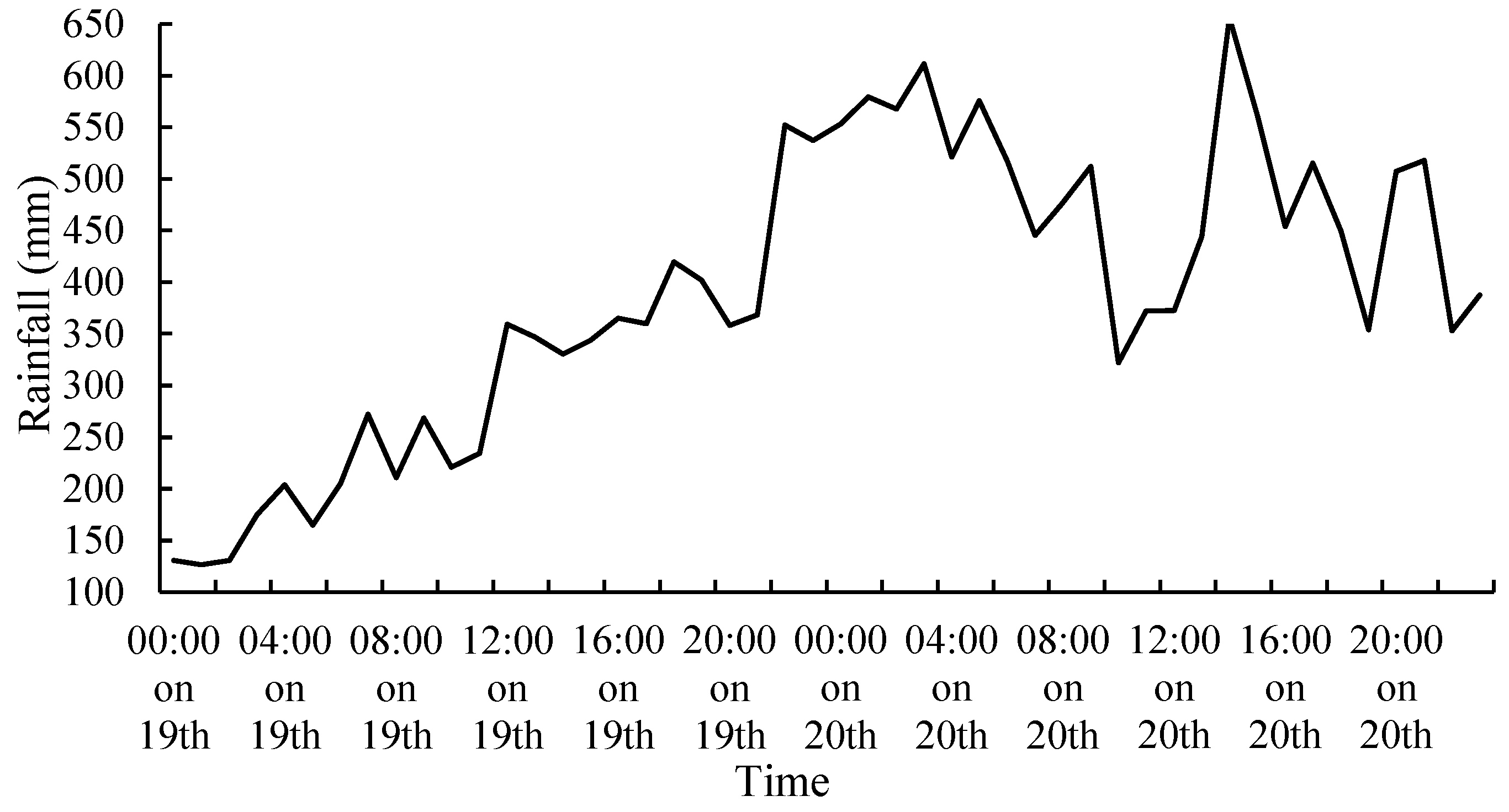
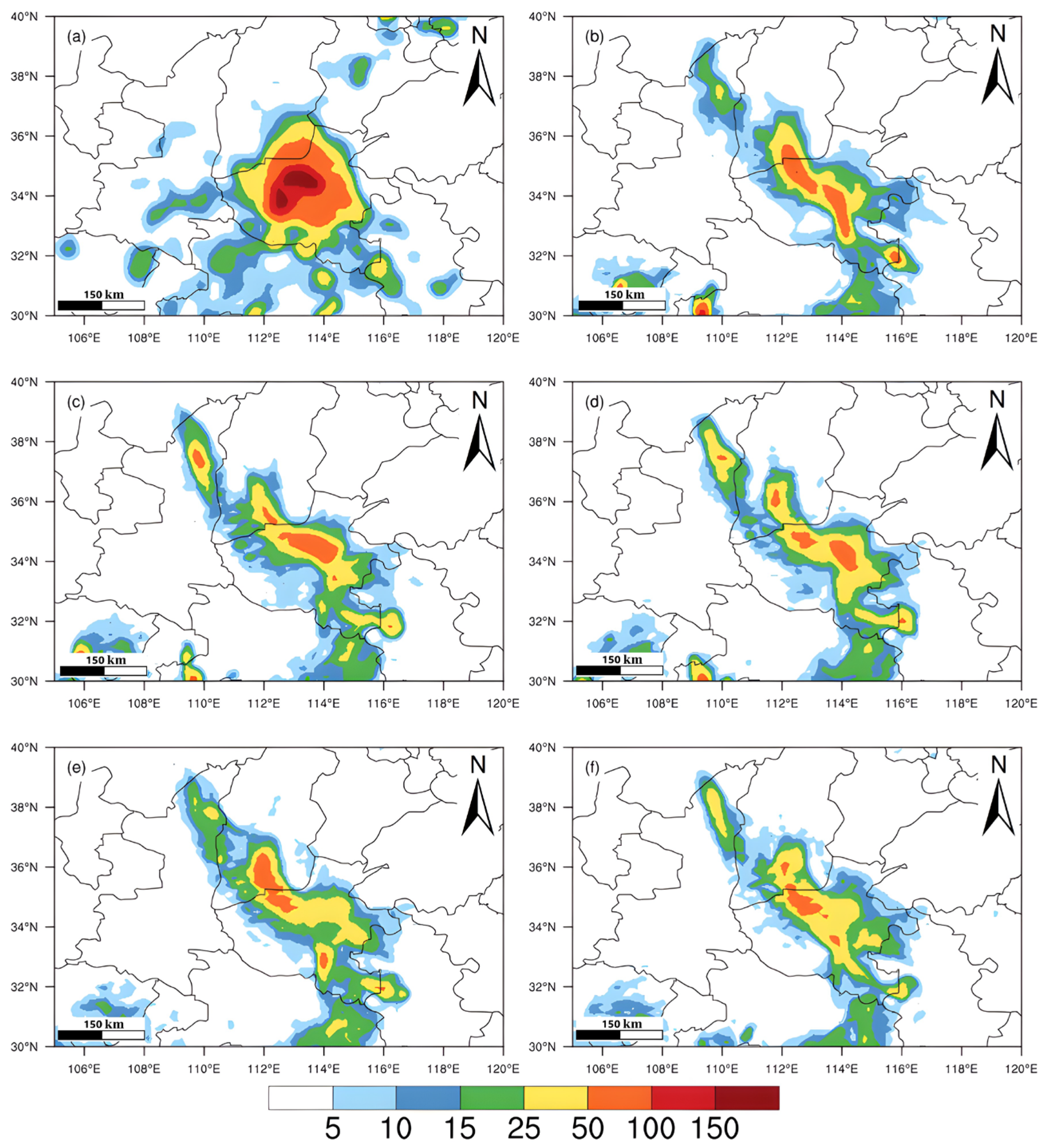
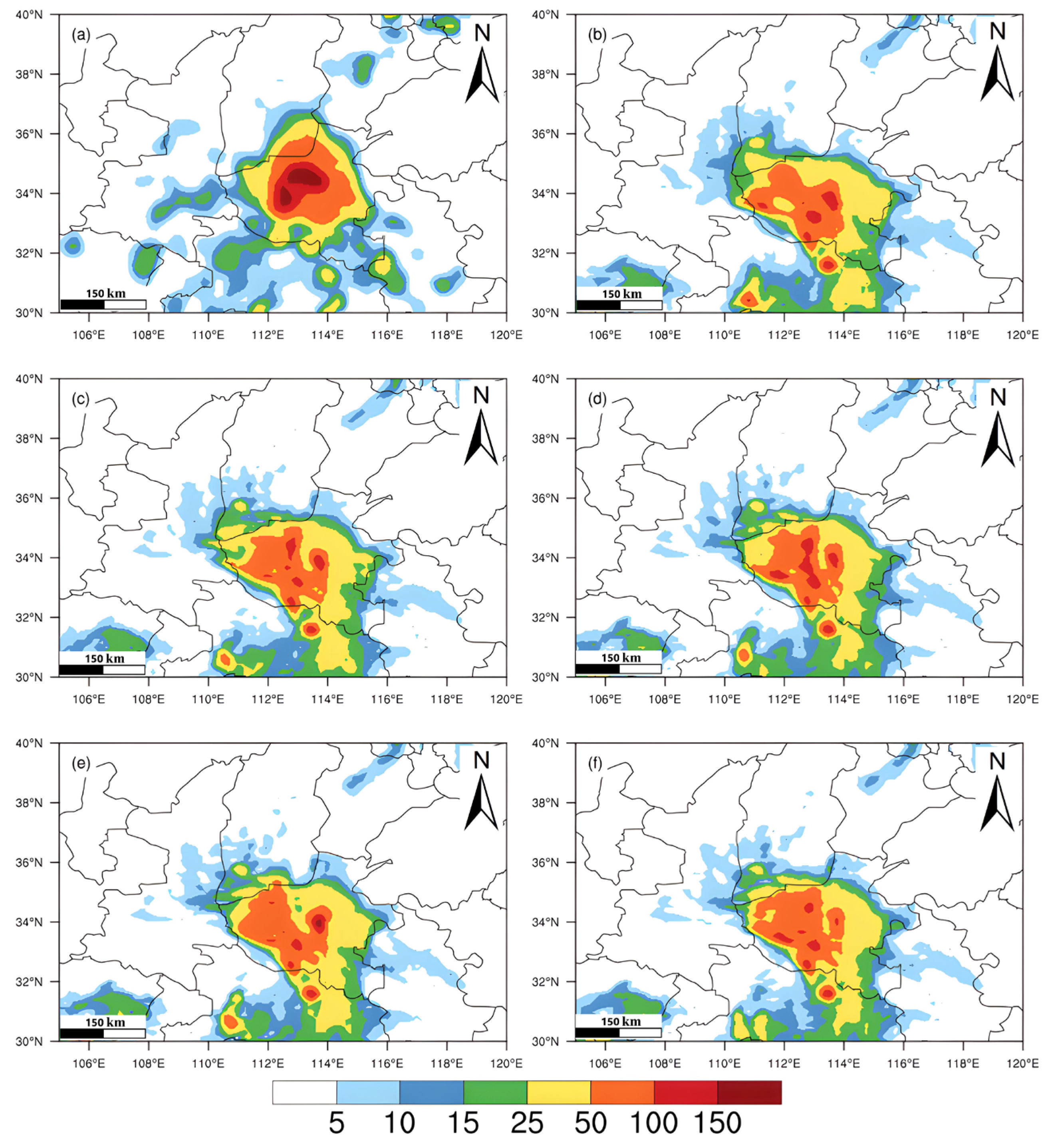
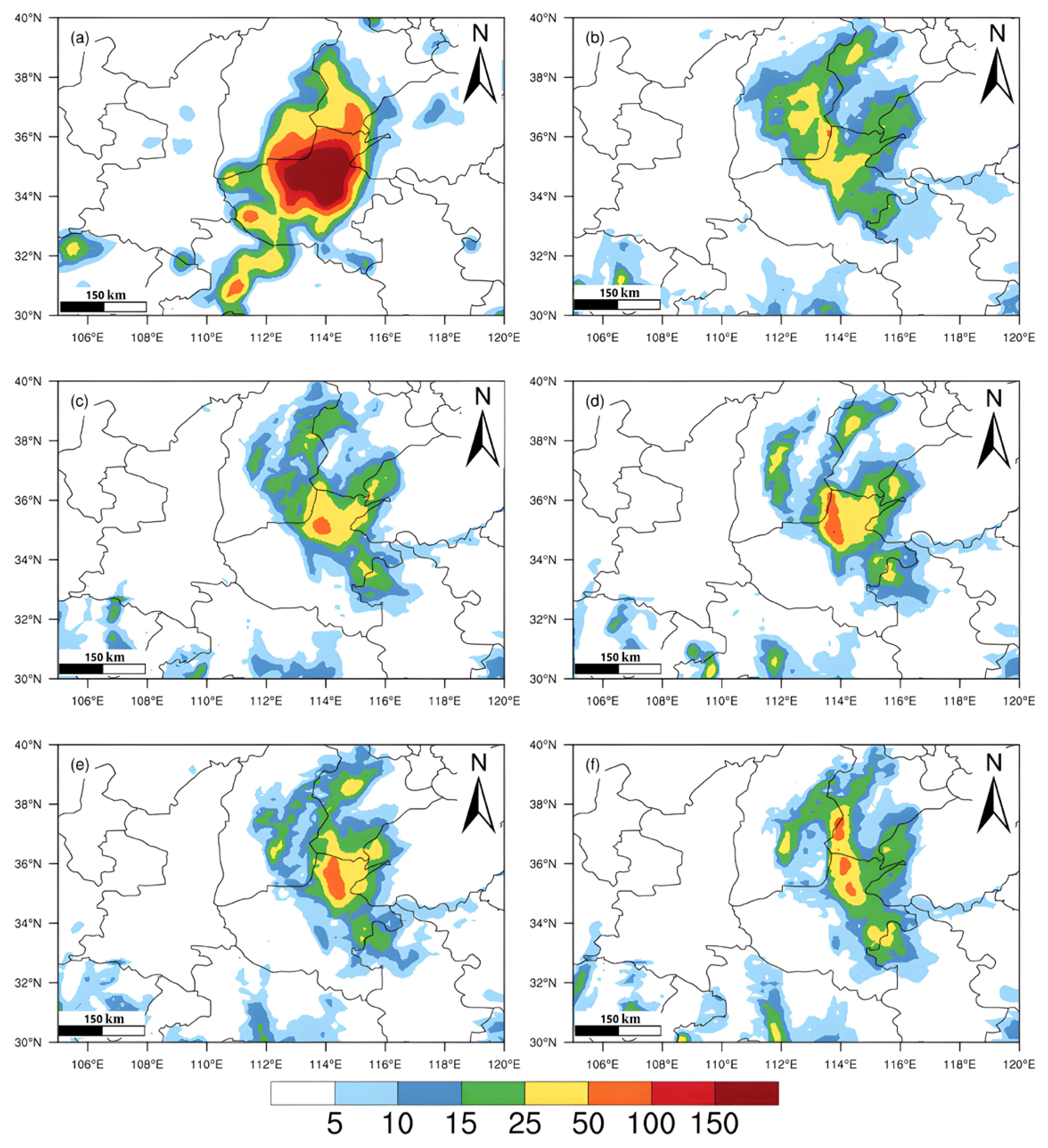
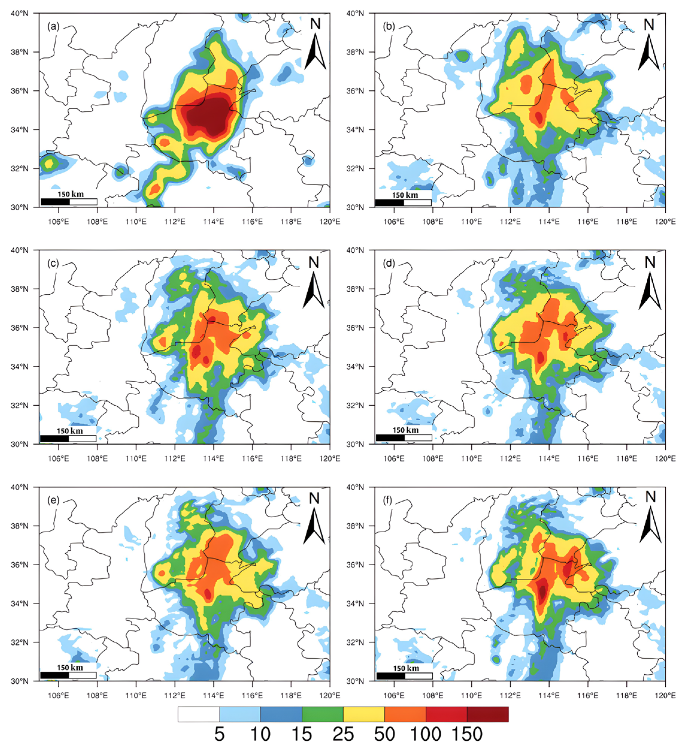
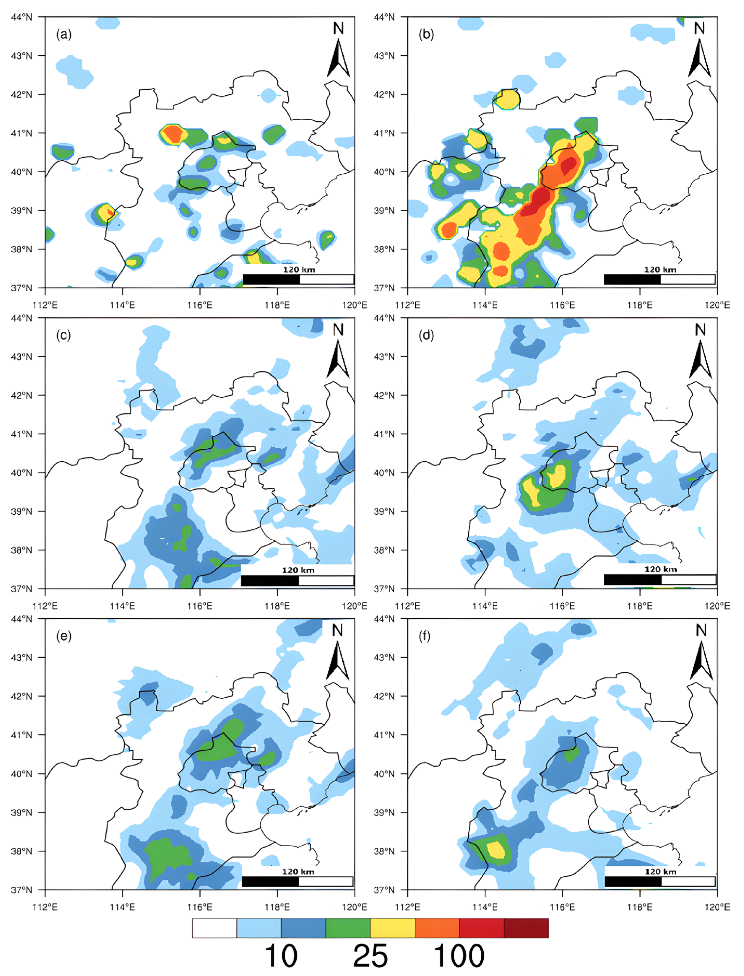
3.2. Simulation of Extreme Rainfall in Henan
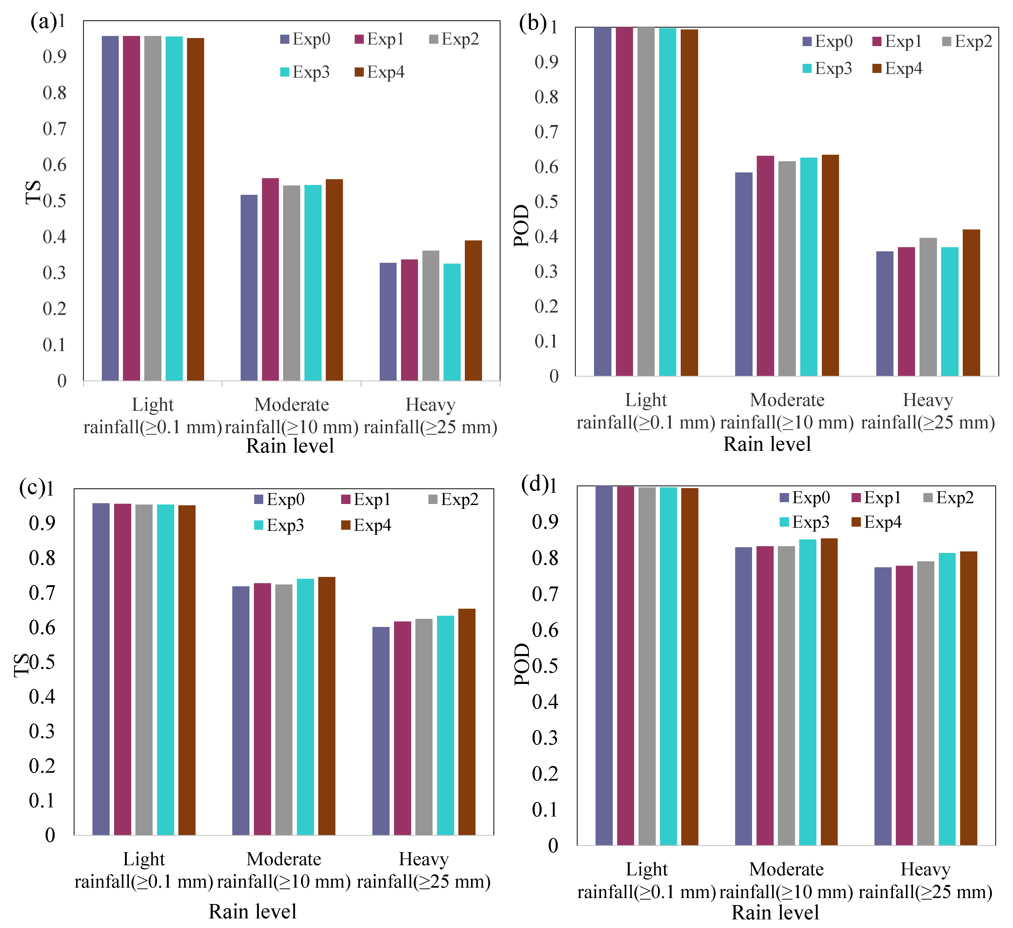
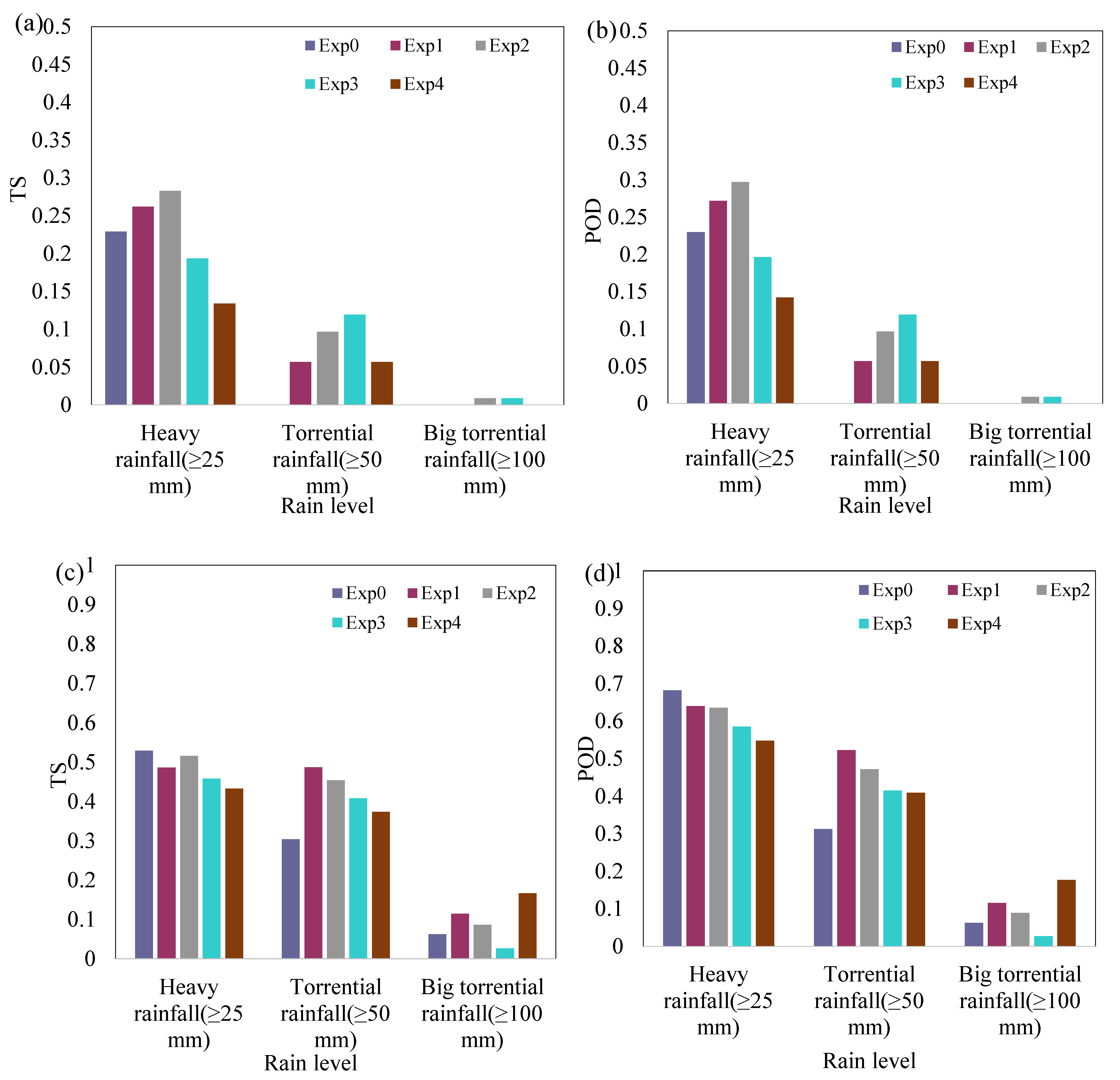
3.3. Quantitative Analysis of Rainfall Simulations
3.4. Analysis of Heavy Rain in Bei**g
4. Discussion
5. Conclusions
Author Contributions
Funding
Institutional Review Board Statement
Informed Consent Statement
Data Availability Statement
Acknowledgments
Conflicts of Interest
References
- IPCC. AR6 Climate Change 2021: The Physical Science Basis; IPCC: Geneva, Switzerland, 2021. [Google Scholar] [CrossRef]
- **, W.; Jun, Z.; Junqiang, S.; Weiming, Z. Preliminary design of dynamic framework for global non-hydrostatic spectral mode. Comput. Eng. Des. 2011, 32, 3539–3543. [Google Scholar] [CrossRef]
- Wang, Y.; Wu, J.; Peng, J.; Yang, X.; Liu, D. Extreme Rainfall Simulations with Changing Resolution of Orography Based on the Yin-He Global Spectrum Model: A Case Study of the Zhengzhou 20·7 Extreme Rainfall Event. Atmosphere 2022, 13, 600. [Google Scholar] [CrossRef]
- Hu, Y.-F.; Yin, F.-K.; Zhang, W.-M. Deep learning-based precipitation bias correction approach for Yin–He global spectral model. Meteorol. Appl. 2021, 28, e2032. [Google Scholar] [CrossRef]


| Experiment Name | With or Without Step (4) | Grid-Point Filter |
|---|---|---|
| Exp 1 | Yes | bidirectional one-dimensional filter |
| Exp 2 | No | bidirectional one-dimensional filter |
| Exp 3 | Yes | direct two-dimensional filter |
| Exp 4 | No | direct two-dimensional filter |
| Exp 0 | Model’s old orography | |
| Rainfall Level | 24 h Total Rainfall (mm) |
|---|---|
| Light rainfall | 0.1–9.9 |
| Moderate rainfall | 10.0–24.9 |
| Heavy rainfall | 25.0–49.9 |
| Torrential rainfall | 50.0–99.9 |
| Big torrential rainfall | 100.0–249.9 |
| Extraordinarily torrential rainfall | ≥250.0 |
Publisher’s Note: MDPI stays neutral with regard to jurisdictional claims in published maps and institutional affiliations. |
© 2022 by the authors. Licensee MDPI, Basel, Switzerland. This article is an open access article distributed under the terms and conditions of the Creative Commons Attribution (CC BY) license (https://creativecommons.org/licenses/by/4.0/).
Share and Cite
Wang, Y.; Wu, J.; Yang, X.; Peng, J.; Pan, X. Orographic Construction of a Numerical Weather Prediction Spectral Model Based on ASTER Data and Its Application to Simulation of the Henan 20·7 Extreme Rainfall Event. Remote Sens. 2022, 14, 3840. https://doi.org/10.3390/rs14153840
Wang Y, Wu J, Yang X, Peng J, Pan X. Orographic Construction of a Numerical Weather Prediction Spectral Model Based on ASTER Data and Its Application to Simulation of the Henan 20·7 Extreme Rainfall Event. Remote Sensing. 2022; 14(15):3840. https://doi.org/10.3390/rs14153840
Chicago/Turabian StyleWang, Yingjie, Jian** Wu, **angrong Yang, Jun Peng, and **aotian Pan. 2022. "Orographic Construction of a Numerical Weather Prediction Spectral Model Based on ASTER Data and Its Application to Simulation of the Henan 20·7 Extreme Rainfall Event" Remote Sensing 14, no. 15: 3840. https://doi.org/10.3390/rs14153840