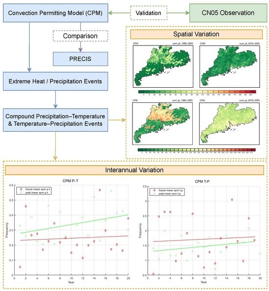
1. Introduction
Currently, extreme events are occurring frequently on a global scale [
1,
2], including novel events such as ocean heatwaves [
3,
4]. Heat events and extreme precipitation are two of the most significant extreme climate events, and both pose harmful impacts on human health, society, and ecosystems [
5]. Compound events—a combination of multiple drivers and/or hazards that contribute to societal or environmental risks—are responsible for many of the most severe weather-related and climate-related impacts [
6].
Since they were first introduced in the Intergovernmental Panel on Climate Change’s (IPCC) Special Report on Climate Extremes (SREX), compound events have risen to public attention for substantially amplifying harms compared to individual extreme events [
6], posing a serious threat to human life and health [
7,
8], agricultural production [
9], energy operations [
10], and infrastructure. The Sixth Assessment Report (AR6) of the IPCC indicates that human-induced climate change is already intensifying global weather and climate extremes, heightening the impact of compound events on societies. For instance, in 2018, Japan experienced a compound extreme event involving heavy rainfall, flooding, and heat waves, which resulted in over 300 deaths and incalculable economic losses [
11]. China similarly faces a severe threat from compound events [
12], with the frequency and intensity of various compound events increasing in recent years [
13]. The research by Yang et al. indicated a significant rise in the duration and intensity of high-temperature–drought compound events in recent years [
14]. Northern China is particularly susceptible to high-temperature–drought compound events, and regions like Yunnan have also experienced such events during the dry season this year. Wu et al. revealed that extreme heat and precipitation compound events in South China have increased by 0.18 events every decade on average over the past few decades, showing an accelerating increasing trend [
8].
Numerous studies have predicted changes in extreme events under various carbon emission scenarios for the future, suggesting that the global climate will undergo significant alterations, with an increase in both the frequency and intensity of extreme events, particularly compound extreme events [
15,
16,
17,
18,
19,
20,
21,
22]. For example, Lu et al. projected that under the RCP4.5 scenario, China’s daily average temperature will rise by 2 °C by the end of the 21st century, while under the RCP8.5 scenario, the increase will be 4 °C [
17]. The average annual precipitation is expected to increase by 58 mm/year and 71 mm/year, respectively. Gao et al. indicated that with intensifying climate change, the frequency and intensity of compound climate events will surpass those of single extreme climate events [
16]. Wang et al. discovered that under the RCP4.5 scenario, three urban clusters—Bei**g-Tian**-Hebei, the Yangtze River Delta, and the Pearl River Delta—will experience unprecedented compound heatwave events around 2045, 2065, and 2030, respectively [
22].
Situated along the southeastern coast of China, Guangdong Province experiences a subtropical climate characterized by frequent heat and rainfall. The Pearl River Delta in Guangdong stands as one of China’s most economically developed and densely populated regions, underscoring the paramount importance of studying and predicting extreme climate events in this region. Research indicates that in the future, both the frequency and intensity of compound extreme events in Guangdong Province are expected to increase, posing new challenges for the government. The study by Wu et al. revealed that regional urbanization has a significant impact on compound extreme events [
23], which is consistent with the findings of Scherrer et al. [
24]. Ren et al. suggested that under the SSP5-8.5 scenario in Guangdong Province, the occurrence frequency, average duration, total intensity, and longest duration of heavy rainfall–heatwave compound events are all projected to increase from 2066 to 2095 [
19]. In this study, we focus on two specific categories of compound events involving extremely high temperature and precipitation. These events encompass scenarios where an extreme precipitation event is succeeded by an extremely high temperature within a three-day window, referred to as a P-T event. Conversely, a T-P event denotes a sequence wherein an extremely high temperature is followed by an extreme precipitation event within three days. Both types of compound events bear the potential for severe repercussions on human communities. In the context of a P-T event, heavy precipitation can result in urban waterlogging and flooding, damaging critical infrastructure such as power facilities and cooling systems [
25]. The subsequent occurrence of a high-temperature event may hinder individuals from accessing adequate cooling mechanisms promptly, exacerbating the health risks linked to elevated temperatures [
26]. In the case of T-P events, heatwaves can accelerate the evaporation process, thereby promoting heavy precipitation [
27]. Concurrently, rapid and intense precipitation may elevate the risk of domestic sewage entering natural water bodies, introducing nutrients that could induce Algal Blooms and Red Tides, particularly in regions where rain and sewage systems remain interconnected. Moreover, the combined effect of high temperature and humidity, resulting from successive occurrences of extreme heat and heavy precipitation, provides an ideal breeding ground for mosquitoes, exacerbating the transmission of insect-borne diseases like dengue fever and malaria. Comprehending the spatial variability in the distribution of compound events is vital to assessing potential hazards and their ensuing impacts. Overall, previous studies have predominantly focused on understanding the causes, impacts, and trends of individual types of compound events [
28,
29,
30], with limited exploration of the interconnections between different types of compound events. Furthermore, the models employed in studying compound events often have resolutions exceeding 25 km
2 [
19,
31,
32,
33], which hinders the accurate simulation of small-scale extreme events such as convective heavy rainfall. As a result, extreme events’ occurrence frequency and intensity may have been somewhat underestimated. In light of this, our study evaluates the performance of the Convection-Permitting Model (CPM) and employs a long-term convection-resolving climate projection for Guangdong Province and its environs using the CPM. By leveraging the CPM, we analyze the spatial distribution and evolution patterns of two types of compound heat–precipitation events: ‘heat after heavy precipitation’ and ‘heavy precipitation after heat’.
2. Model, Data, and Methods
The Convection-Permitting Model (CPM) offers various options related to the model’s core and physical parameterization schemes, including boundary layer, convection, microphysics, and radiation schemes, as well as multiple land surface models to choose from. The model employs a fully compressible, non-hydrostatic dynamical equation-solving core, rendering it suitable for simulations across various spatial scales, ranging from thousands of kilometers to just a few meters [
34,
35]. When properly configured, the CPM can conduct reliable, long-term climate simulations at a regional scale. Due to finite computational resources, we opted to downscale the CPM to a high-resolution level of 4 km for this study.
In this study, the WRF (Weather Research and Forecasting Model), which is believed to be a state-of-the-art mesoscale numerical weather prediction system designed for both atmospheric research and operational forecasting applications, is chosen as the CPM. The CPM is configured with a three-layer nested grid scheme (refer to
Figure 1). The outermost domain, labeled as D01, encompasses a significant portion of South China, boasting a resolution of 36 km and a total of 78 × 66 grid points. This outer domain helps to mitigate spurious boundary effects within the inner regions. The second nested domain, D02, comprises 144 × 98 grid points with a resolution of 12 km. Finally, the innermost domain, D03, covers Guangdong Province and consists of 222 × 186 grid points, with a fine grid resolution of 4 km. The core layer, D3, encompasses both the ocean and land. Thus, our CPM incorporates ocean–atmosphere coupling, land–atmosphere coupling, and ocean–land coupling.
This high resolution is sufficiently refined to simulate convective processes and to accurately capture intricate terrain features, including coastlines, mountains, and urban areas. The CPM incorporates 21 vertical levels, with the uppermost level situated at the 50 hPa atmospheric pressure level. Initial and lateral boundary conditions are sourced from the ERA-Interim reanalysis product, characterized by a resolution of 50 km × 50 km, and are updated at six-hour intervals. The CPM is run on the Tianhe-2 supercomputer platform scaled to 300,000 processor cores and achieves a speed of 1.64 simulation days per hour. The computational efficiency is increased by multi-dimension-parallelism structuring, finer-grained optimization, parallelized input/output fragmenting, and manual vectorizing to enable the 10-day regional climate simulation over the study area.
The three domains are interlinked through two-way nesting, with boundary values from the coarse-resolution domain driving the fine-resolution domain and, reciprocally, the fine-resolution contributing its computed results to the coarse-resolution. This two-way strategy facilitates the transmission of mesoscale information from D02 to higher-level domains, intending to enhance the driving performances of D01 and D02. All three domains share the same physical parameterization schemes, except the convective scheme, which remains inactive within the innermost domain, D03. This deliberate omission of the convective scheme in D03 enables the model to explicitly resolve convective processes. Cloud microphysics processes possess the capability to influence the onset and evolution of cumulus convection by modifying the temperature and humidity, thereby impacting precipitation projections [
36,
37,
38].
The WRF model is configured with specific parameterizations, including the Kain–Fritsch cumulus scheme, the Yonsei University boundary layer scheme, the Monin–Obukhov surface-layer scheme, the Rapid Radiative Transfer Model long-wave radiation scheme, and the Dudhia short-wave radiation scheme [
39,
40,
41,
42,
43]. These parameterizations are consistent across three domains, except for the innermost domain D03, which excludes convective parameterization to allow for explicit convection. Cloud microphysics significantly influences the temperature, humidity, cumulus convection, and precipitation forecasts [
44]. We evaluate three cloud microphysics schemes: the Lin scheme, the WSM3-class simple ice scheme, and the WSM5-class scheme [
45]. In a sensitivity analysis spanning three summer months (1 June to 31 August 1981), we examine temperature and precipitation variations under different microphysics parameterizations. Temperature simulations closely match the observations across all schemes, making it challenging to identify an optimal scheme. However, the precipitation simulations display significant sensitivity to microphysics choices, particularly on heavy precipitation days. The WSM5 scheme outperforms the Lin and WSM3 schemes, earning the designation as the optimal cloud microphysics parameterization for the WRF model.
This study judiciously selects the future temporal span from 2074 to 2099 for convection-resolving climate projection, with constraints established through the utilization of the ERA-Interim reanalysis product. The ERA-Interim data provide a valuable resource for climate research, offering a comprehensive dataset with notable strengths. Its spatial and temporal completeness, along with its high resolution, facilitate a deep understanding of climate dynamics. Improved low-frequency variability and stratospheric circulation compared to its predecessor (ERA-40) enhance its utility for various applications [
46], despite the inherent uncertainty in ERA-Interim data. Beyond observational uncertainty, sources of uncertainty stemming from model configurations, numerical techniques, vertical resolution, and boundary conditions play a significant role. These factors can explain differences in simulated climates. Notably, the models’ uncertainty often surpasses observational uncertainty [
47]. Moreover, caution is needed when interpreting results due to the dataset’s tendency to depict excessively intense water cycling over oceans. Researchers must consider these limitations when utilizing ERA-Interim data in climate studies. The projections’ initiation and boundary conditions are formed by combining continuous perturbation signals using the Pseudo-Global Warming (PGW) technique [
48]. This approach entails the perturbation of key physical fields encompassing temperature, geopotential height, specific humidity, horizontal wind, sea surface temperature, sea level pressure, and soil temperature. The distinctive climate perturbation signal is derived through a methodical utilization of the multi-model ensemble’s mean climate change, as delineated by Equation (1):
where CPM
input denotes the lateral boundary condition for driving the CPM; ERA represents the ERA-Interim reanalysis data; GCMs
future is the ensemble mean of 10 CMIP5 GCMs for the 2074–2099 period; and GCMs
historical is the ensemble mean of 10 GCMs for the 1981–2005 period.
Following the derivation of the climate change signal, the ERA-Interim reanalysis data undergo perturbation at six-hour intervals. This process culminates in the generation of the initial and boundary conditions requisite for the CPM’s future climate projection. The foundation of our future climate projection hinges on the output data emanating from the Global Climate Models (GCMs) entrenched within the Coupled Model Intercomparison Project 5 (CMIP5), operating under the RCP8.5 scenario. As the foundation of CPM, GCMs take ocean–atmosphere coupling into account to ensure the accuracy of the results. In a deliberate effort to mitigate the sway of model uncertainty on the quantification of climate response in the face of impending greenhouse gas forcing, a selection criterion is applied. Specifically, we opt to incorporate 10 CMIP5 GCMs, electing these models based on their commendable performance in replicating China’s climatic patterns. The simulation data from multiple GCMs, including MIROC-ESM, GFDL-CM3, MRI-CGM3, MRI-CGCM3, CMCC-CM, HadGEM2-CC, and HadGEM2-ES, are employed to encompass a spectrum of historical convective storm environments, spanning from high to low values of mixed-layer convective available potential energy over South China. Additionally, we incorporate output from other CMIP5 models, IPSL-CM5A-LR, CanESM2, and CSIRO-Mk3.6.0, to introduce further variability across the range of delta, which constitutes the PGW signals [
49,
50,
51]. A compendium of detailed information about these 10 GCMs is accessible in
Table 1.
To evaluate the performance of the deployed CPM, we judiciously select the Providing REgional Climates for Impacts Studies (PRECIS) model for comparative analysis while employing the CN05 gridded observation dataset as the yardstick of reference. The PRECIS model stands as an exemplary Regional Climate Model (RCM), deployable across any geographic expanse, and meticulously crafted by the Hadley Center of the UK Met Office. This hydrostatic, primitive equation model operates with a horizontal resolution of 25 km [
52].
CN05 dataset is a gridded daily observation dataset with a spatial resolution of 0.25° × 0.25°, which records the daily mean temperature, minimum temperature, maximum temperature, precipitation, mean wind speed, etc. [
53]. The CN05 dataset is constructed with the ‘anomaly approach’ using more than 2400 national-level stations across China. We employ the observation data from 1 January 1981 to 31 December 2005 as the reference data. Guangdong Province is geographically partitioned into four primary regions: Northern Guangdong, Eastern Guangdong, Western Guangdong, and the Pearl River Delta. Northern Guangdong (North GD) comprises Shaoguan, Qingyuan, Meizhou, and Heyuan. Eastern Guangdong (East GD) comprises Shantou, Chaozhou, Jieyang, and Shanwei. Western Guangdong (West GD) includes Zhanjiang, Maoming, Yangjiang, and Yunfu. The Pearl River Delta (PRD) envelops Guangzhou, Shenzhen, Foshan, Dongguan, Zhongshan, Zhuhai, Jiangmen, Zhaoqing, and Huizhou.
This study identifies the daily maximum temperature that surpasses the 90th percentile value of temperatures recorded across all days as an extreme heat event. Similarly, the procedure is replicated for the identification of extreme precipitation events. The 90th percentile threshold and its resultant extreme events are ascertained on a per-grid basis, both for historical and projected future time spans. The fraction of the P-T events is elucidated as the proportion of extreme precipitation events that are preceded by an extreme heat event within 3 days. Similarly, the fraction of T-P events is parallelly defined, representing the percentage of extreme heat events that are followed by an extreme precipitation event within a 3-day interval. In the subsequent presentation of our results, we use the term ‘frequency’ to refer to the number of times a particular event occurs.
3. Results
3.1. CPM Performance Evaluation
In
Figure 2a–c, the spatial distribution of both the observed and two simulated total annual precipitation values across Guangdong Province is presented for the temporal span from 1981 to 2005. Specifically, the observational data reveal that the total annual precipitation over Guangdong Province from 1981 to 2005 exceeded 1200 mm/year, except for the mountainous regions in Western and Northern Guangdong. The precipitation generally exhibited a decline from the coast towards the interior. The greatest precipitation levels were recorded in the eastern part of West GD, the northeastern sector of the Pearl River Delta, and the southern area of East GD along the coastline, surpassing 1800 mm/year.
When comparing these observations to the simulation results of the PRECIS, a consistent trend of precipitation underestimation becomes apparent across the entirety of Guangdong Province. This underestimation is particularly pronounced within the Pearl River Delta and the majority of Northern Guangdong, where the precipitation levels fall below 1000 mm/year. Another notable discrepancy is the shift of high precipitation regions towards the coastal zones of Western and Eastern Guangdong. In contrast, the simulation outcomes of the CPM indicate a total precipitation of approximately 1300 mm/year over Guangdong Province, which is close to the corresponding figure for observation outcome. The areas of elevated precipitation are concentrated along the western coast of the Pearl River Delta and the Leizhou Peninsula (the southmost part of Guangdong). Although some minor underestimations persist in parts of Northern Guangdong, the overall agreement with the observed data on the magnitude of values surpasses those of the PRECIS.
Figure 2d–f illustrate the spatial distribution of the 90th percentile maximum daily precipitation, indicative of extreme precipitation events, during the historical period. The observed data reveal a spatial distribution pattern of extreme precipitation that aligns with the total annual precipitation depicted in
Figure 2c. This pattern generally exhibits a gradual reduction from the coast towards the interior, with a notably higher intensity observed in the Pearl River Delta region. In contrast, the results from the PRECIS model exhibit a conspicuous underestimation of extreme precipitation intensity, particularly in inland areas. The maximum recorded extreme precipitation across the entire province is a mere 12 mm/day. On the other hand, the simulation conducted using the CPM shows a closer approximation to the observed data. However, persistent and anomalous underestimations remain in most of Northern Guangdong and the northern section of the Pearl River Delta, which is consistent with the model’s performance in simulating the total annual precipitation. On the whole, the CPM simulations numerically outperform PRECIS in mean and extreme precipitation variation amplitude. However, CPM’s disparities with observed values persist, particularly in high-precipitation areas.
Figure 3a–c illustrate the spatial distribution of the mean temperature. Both model simulations accurately capture the observed pattern. The average temperature distribution across Guangdong Province during the historical period exhibits pronounced latitudinal heterogeneity, with temperatures decreasing from 27 °C to 18 °C as the latitude increases. Notably, the Pearl River Delta region registers an average temperature of 1–2 °C higher than that of the other regions at the same latitude. This temperature disparity can be attributed to the region’s significant urbanization and the strong heat island effect it generates.
The PRECIS model’s simulation successfully depict the latitude-based temperature variations, albeit with an overall underestimation of 5 °C compared to the observed data. Conversely, the simulation outcomes of the CPM align closely with the observed data. Because the grid coverage area in the CPM is relatively small, the model is enabled to effectively reflect the impact of terrain and land use type differences on climate factors. For instance, the elevated values observed in the Pearl River Delta and the Leizhou Peninsula precisely capture the impact of urban and mountainous areas on the formation of high-temperature zones.
Figure 3d–f portray the spatial distribution of the 90th percentile maximum daily temperature, serving as indicators of extreme temperature events, during the historical period. The CPM aptly captures the observed spatial distribution of extremely high temperatures. Notably, the regions experiencing extremely high temperatures extend from the Pearl River Delta into the surrounding areas. Along the coastlines and higher elevation zones, the simulated extreme high-temperature intensities register lower values compared to other regions at the same latitude. This variation can be attributed to the influence of expansive water bodies and variations in the terrain elevation.
Contrastingly, the simulation outcomes of the PRECIS model for extremely high temperatures in Guangdong Province are consistently lower than the observed data by approximately 4 °C on average. Additionally, the PRECIS model fails to accurately depict spatial characteristics, such as the presence of an extremely high-temperature center situated within the Pearl River Delta. Overall, the extremely high-temperature values obtained from the CPM closely align with the observations, differing by less than 0.5 °C. Moreover, the CPM effectively captures the accurate distribution of both the high- and low-value centers. Instances where the CPM simulations yield lower values than the observed data can be attributed to the sparse nature of the observational stations used to gather the data. The higher resolution of the CPM compared to the observational dataset enables it to better reflect the influence of the underlying surface morphology and other pertinent factors on climatic elements, leading to more faithful and reliable results.
In conclusion, the simulation outcomes of the CPM exhibit a higher degree of consistency with the observed data in terms of the precipitation values, while the PRECIS model displays noticeable underestimations. This discrepancy is particularly pronounced in the spatial distribution of extreme precipitation, where the CPM results demonstrate significant enhancements over the PRECIS model results. Regarding temperature simulation, both the spatial distribution and the accurate representation of extreme temperature values closely align with the observations in the CPM, surpassing the capabilities of the PRECIS model. Consequently, it can be asserted that the simulation results derived from the CPM offer a significantly higher level of precision compared to the PRECIS model.
Given the premise that a model that is capable of providing precise historical simulations is also likely to furnish reliable estimations of future changes, the projections stemming from the CPM for the future period carry a greater level of fidelity than those derived from the PRECIS model.
3.2. CPM and PRECIS Projection Results
Figure 4a,b illustrate the spatial distribution of changes in the mean daily precipitation across Guangdong Province under the RCP8.5 scenario from 2074 to 2099 in comparison with the period of 1981–2005. The model projection at a 25 km resolution indicates a decrease in precipitation around the Pearl River Delta, ranging from 0 to 0.5 mm/day, with coastal areas of Eastern Guangdong experiencing reductions of over 1 mm/day. However, some elevated regions show an increase in precipitation. The CPM similarly depicts an overall decrease in the mean precipitation across the province, although the reduction is comparatively less pronounced than that of the PRECIS model. In contrast to the PRECIS model results, the CPM projects a general decrease of over 1 mm/day in precipitation for the Eastern Guangdong region, while certain coastal areas in Western Guangdong show an increase of more than 0.5 mm/day. Additionally, a substantial upward trend of more than 0.5 mm/day is observed in a significant portion of Northern Guangdong.
The IPCC Fifth Assessment Report highlights that under the RCP8.5 scenario, there exists a high likelihood of a significant increase in global drought frequency by the close of this century. This trend is anticipated to be particularly severe in low-latitude regions, which aligns with the projected overall reduction in the mean precipitation. It is worth noting that the CPM tends to overestimate precipitation in the mountainous areas of Northern Guangdong. This discrepancy, albeit less pronounced, can be attributed to the model’s historical period underestimation of precipitation in the Northern Guangdong region.
Figure 4c,d depict the spatial distribution of the predicted changes in extreme precipitation as projected by the two models. The spatial patterns evident in the PRECIS model’s results closely resemble those illustrated in
Figure 4b, which represent the daily mean precipitation. In contrast, the outcomes of the CPM indicate a provincial increase in the extreme precipitation intensity. Particularly noteworthy is the pronounced increase observed in most of Northern Guangdong and the northern segment of the Pearl River Delta. This increase notably surpasses that projected by the PRECIS model. Given the parameterization of convective precipitation and the historical simulation’s limited reliability in the PRECIS model, we assert that the PRECIS model significantly underestimates the future surge in extreme precipitation.
Figure 5a,b highlight the spatial distribution of changes in the mean temperature between the future and historical periods. The PRECIS model forecasts a rise of approximately 4.5 °C across the majority of Guangdong Province. However, considering that the model’s historical simulation consistently lags behind the observations by 5 °C, the possibility of underestimating the mean temperature increase under the RCP8.5 scenario remains. As predicted by the PRECIS, regions featuring elevated terrain may experience temperature rises as modest as 1.5 °C. In the CPM results, a distinct zonal pattern emerges, ranging from the sea to land, with warming intensity gradually amplifying from the coastline towards the interior (rising from 1 °C to over 3.5 °C). This intensity is notably lower than the projections of the PRECIS model.
Considering that inland mountainous regions possess a lower specific heat capacity, while the ocean boasts a higher one, the ocean exerts a substantial regulatory influence on temperature changes. Within the context of a warming future climate, it follows that inland areas should experience higher warming variations compared to coastal regions. The CPM adeptly captures this variation trend. We believe that the CPM’s simulation of the future mean temperature changes in Guangdong Province holds greater reliability than that of the PRECIS model.
Figure 5c,d showcase a comparative spatial distribution of the projected changes in extreme temperature. The PRECIS model’s results indicate a more pronounced rise in extremely high temperatures, gradually escalating from the coast towards the interior, with the most substantial increase surpassing 6 °C in the northern portion of Northern Guangdong. Conversely, the results of CPM do not exhibit such oceanic variations, and the warming magnitude it portrays is generally lower than that of PRECIS. Notably, certain areas in Western and Northern Guangdong register an increase of approximately 5 °C. The Leizhou Peninsula exhibits a milder increase, directly attributed to its proximity to the sea on three sides and the substantial oceanic influence.
3.3. Temperature–Precipitation Relation
Figure 6 presents the temperature–precipitation relationship curve based on observations, along with historical (
Figure 6a) and future (
Figure 6b) simulations from both the CPM and PRECIS model. The values depicted on the y-axis represent the 90th percentile of maximum daily precipitation occurring together with the certain daily maximum temperature indicated on the x-axis. These values are derived from statistical analysis of daily observational and simulated data over a specific period. Utilizing the Clausius–Clapeyron Relation [
54], we can establish the connection between the changes in extreme precipitation intensity and temperature elevation. With increasing temperatures, the corresponding intensity of extreme precipitation at that temperature exhibits a trend of initial increase followed by a decrease. This phenomenon can be attributed to the cooling effect associated with intense precipitation [
55].
In
Figure 6a, the historical period results from the PRECIS model broadly align with the changing trend observed in the precipitation–temperature curve. The temperature value corresponding to the peak of precipitation intensity closely mirrors the observational data, both hovering around 24 °C. Nonetheless, the precipitation intensity remains generally subdued, consistent with prior spatial distribution findings (
Figure 2). This consistency primarily arises from the PRECIS model utilizing convective parameterization, which neglects short-duration, localized, and intense convective precipitation, thereby resulting in an underestimation of extreme precipitation events. The CPM results, on the other hand, exhibit a more pronounced cooling effect. Notably, the precipitation intensity correlated with temperatures exceeding 20 °C closely adheres to the observed trend, maintaining a consistent peak. However, an evident underestimation of extreme precipitation intensity emerges for temperatures below 20 °C.
In
Figure 6b, within the context of the future RCP8.5 scenario, the CPM projects an overall escalation in precipitation intensity. Notably, extreme precipitation intensity below 15 °C experiences a substantial increase relative to historical stages, accompanied by more pronounced fluctuations. Concurrently, the temperature corresponding to the estimated peak precipitation registers a slight reduction. Conversely, the PRECIS model predicts a weakening of extreme precipitation intensity in the future. The peak intensity is anticipated to decrease from the historical 20 mm/day to 16.5 mm/day. Additionally, the temperature corresponding to the future peak shifts towards higher temperatures, approaching approximately 27 °C.
3.4. Develo** Trends of Two Kinds of Compound Heat–Precipitation Events
Figure 7 displays the projected outcomes concerning the total frequency of P-T events for both past and future periods, as determined by the two models and observational data. The historical period spans from 1986 to 2005, while the future period encompasses the years from 2076 to 2095, each comprising 20 years. In a similar vein,
Figure 8 portrays the probability of an extremely high-temperature event occurring within three days following an extreme precipitation event—a metric known as the fraction of P-T events. Complementing these visualizations,
Table 2 furnishes comprehensive statistics detailing the average and maximum frequency values across Guangdong Province and its distinct regions.
From
Figure 7, it becomes evident that the total count of P-T events simulated by the PRECIS model significantly surpasses that projected by the CPM, encompassing both past and future periods. The results obtained from the PRECIS model significantly overestimate the frequency of P-T events. Additionally, the spatial distribution patterns do not align with the observational data. It can be concluded that the PRECIS model exhibits a lower level of accuracy in simulating P-T events. The PRECIS model’s results exhibit a prevailing trend of decrease from the coastal regions to inland regions, with regions of elevated frequency concentrated in Eastern and Western Guangdong. The prior model comparison has already underscored the imprecision of the PRECIS model’s outcomes, and the subsequent quantitative data expounded upon in the subsequent text serves to amplify these limitations. Concentrating on the 4 km resolution model, we ascertain that over the past 20 years, P-T events primarily occurred in areas characterized by substantial elevation variations, such as Northern and Eastern Guangdong. The highest frequency reached 136 occurrences, with an average of 27.2 in Northern Guangdong. However, the observational data indicate that P-T events are more frequent along the coast of Western Guangdong and the Leizhou Peninsula, while the Northern Guangdong region experiences a lower frequency of P-T events. This differs from the spatial distribution simulated by the CPM. In the ensuing 20 years, the area experiencing the highest P-T event frequency transitions to the Pearl River Delta, reaching a maximum of 87 occurrences and an average of 16.19. Provincially, the frequency of P-T events displays a decrease from 20.32 times per year in the past period to 14.55 times per year in the future period. Notably, the spatial patterns concerning the fraction and total frequency of T-P events exhibited by both models are strikingly congruent. While the current CPM may not accurately replicate the spatial distribution patterns of P-T events, it exhibits numerical variation amplitudes that are relatively close to the observed values.
To delve deeper into the annual variation trend of T-P event occurrence frequency, we introduce the statistical chart depicted in
Figure 9a–c. The y-axis represents the average frequency (i.e., total count) within each grid across the province. For the CPM, we showcase both a scatter plot and the linear regression results for the frequency–year relationship, while the insignificance of linear regression outcomes for the PRECIS model limits our presentation to a line chart. The results generated by the CPM unveil a substantial year-by-year increase in P-T event frequency over the past two decades, the same situation seen in the observational data, while this trend displays less significance for the subsequent 20 years. A shared pattern between both models emerges, indicating a general decrease in the frequency of T-P events during the future period compared to the past.
We endeavor to elucidate the underlying reasons for the observed trends in the CPM results, drawing insights from various angles. According to the Clausius–Clapeyron Relation, a substantial escalation in near-surface temperatures invariably accompanies an increase in extreme precipitation occurrences. For each 1 °C of warming, saturated air contains 7% more water vapor [
56]. Reflecting on the temperature–precipitation relationship depicted in
Figure 6, a distinct provincial trend emerges: as the precipitation extremes materialize in the future period, the corresponding temperatures decline, concomitantly with an increase in the precipitation extremes. This shift is emblematic of a potent cooling effect facilitated by precipitation. Consequently, the likelihood of extremely high-temperature events transpiring after intense precipitation diminishes, thereby leading to a corresponding reduction in the frequency and fraction of P-T compound events.
Delving into regional variations, in locales characterized by substantial elevation differences such as Northern Guangdong, a predominant portion of precipitation dissipates via runoff, with only a fractional proportion infiltrating the soil. This results in a relatively low underlying surface water content. After heavy precipitation, the sensible heat effect efficiently transfers heat to the atmosphere, consequently fostering the emergence of extremely high temperatures—a pivotal precursor to P-T compound events, which is attributed to the higher frequency of P-T events in the region. Meanwhile, the Pearl River Delta, though marked by a low level of urbanization towards the close of the preceding century, is projected to attain elevated urbanization levels by the current century’s end. Urbanized underlying surfaces, characterized by impermeability, can exert a warming effect that surpasses the influence of elevation differences. Consequently, the frequency of such events is expected to surge in this vicinity. Turning our attention to the Leizhou Peninsula situated in Western Guangdong, its tropical location, flanked by the sea on three sides, translates to consistently high temperatures and year-round rainfall. Within this context, the cooling effect induced by individual heavy precipitation events remains relatively modest. Simultaneously, the upshot of global warming—resulting in heightened temperatures across low latitudes—contributes to the proliferation of P-T events in this region.
Figure 10 provides insight into the spatial distribution of the total T-P event frequencies within both past and future periods, as determined using the two models and observational data. In tandem,
Figure 11 elucidates the fraction of P-T events—signifying the likelihood of an extreme precipitation event transpiring within three days after an extreme high-temperature event.
Table 3 supplements these visualizations, presenting intricate statistics encompassing the average and maximum frequency across four distinct regions.
Remarkably, the results generated by the CPM indicate a noteworthy shift in the concentration area of T-P event occurrences—from Northern Guangdong (averaging 104.35 times) during the past period to the Pearl River Delta (averaging 110.9 times) during the future period. Nevertheless, the overall distribution manifests a tendency towards dispersion throughout the province. At the provincial level, the frequency of T-P events is poised for a significant future increase, and is anticipated to ascend from 87.2 to 101.38 occurrences. Notably, the frequency of T-P events surpasses that of P-T events multiple times over, spanning both past and future periods. The outcomes attributed to the PRECIS model no longer conspicuously exhibit a coastal–continental zonality. However, the CPM exhibits a certain degree of underestimation in the frequency of T-P events in the eastern and western regions of Guangdong. The simulation of T-P events by the CPM has shortcomings that require further optimization in future research. The spatial arrangement of the fraction of T-P events illustrated in
Figure 11 resonates strikingly with the total frequency pattern depicted in
Figure 10. However, the projection offered by the PRECIS does not indicate a pronounced spatial shift during the future period, in contrast to the CPM projection, which hints at a more uniform spatial distribution.
Turning our attention to
Figure 9d–f, we gain insight into the annual variation of the provincial average frequency. The outcomes gleaned from the CPM unveil an annual upward trend in the frequency, which is evident in both the past and future periods. Importantly, the frequency projections for the future period exceed those of the past, thereby diverging from the trend observed in P-T events. In contrast, the results generated by the PRECIS model do not reveal a significant linear relationship.
The IPCC’s Sixth Assessment Report indicates that global warming accentuates the frequency of extremely high-temperature events. Given the province’s geographical location, situated within tropical and subtropical realms, occurrences of extremely high temperatures are conducive to triggering convective precipitation—an instrumental source of extreme precipitation. The Pearl River Delta boasts the highest urbanization rate, thereby intensifying the urban heat island effect and consequent extreme high-temperature events. Consequently, as the current century draws to a close, the frequency of T-P events is anticipated to surge notably within the Pearl River Delta region.
4. Discussion
The formation of extreme precipitation predominantly arises from vigorous convection, driven by intense vertical air movement. Importantly, the CPM aptly accommodates these convection dynamics, while the PRECIS model lacks this capacity. Consequently, the CPM inherently offers greater theoretical reliability, despite its underestimation of precipitation in Northern Guangdong. We present possible reasons for this underestimation phenomenon while acknowledging that additional underlying mechanisms warrant further investigations. Furthermore, due to the limited number of observational stations, the reference value provided by the observational data used in this study is constrained. The performance of our CPM awaits further validation against similar models.
Here, compound events are defined as events where extreme precipitation and extremely high temperatures occur simultaneously within a three-day window. The choice of this timeframe together with the 90th maximum value as thresholds has been widely adopted in similar studies [
13,
16,
23]. Considering the regional climate variations and varying disaster resilience levels, we customized thresholds for each grid rather than applying uniform ones for the whole study area. Future research may therefore explore adjusting these thresholds for improved suitability to specific study areas.
Long-term elevated temperatures prompt heightened surface evapotranspiration, conducive to the formation of convective processes, further promoting the occurrence of extreme precipitation events. Concurrently, intense rainfall contributes to temperature reduction. This intricate interplay explains the prevailing trend of T-P events occurring more frequently than P-T events. The overall occurrence frequency for the two types of compound events predicted by the PRECIS model is higher than that of the CPM. This is attributed to the PRECIS model’s deficiency in resolving convective processes, leading to anomalous forecasts of extreme precipitation events.
According to the CPM, the frequencies of P-T and T-P events exhibit inverse trajectories of increase and decrease over the two temporal spans, an observation that is possibly linked to global warming. On one hand, rising temperatures expedite the water cycle, augmenting the frequency of T-P events. Conversely, as
Figure 6 illustrates, extreme precipitation tends to mitigate temperature spikes. A higher temperature is associated with a more pronounced cooling effect induced by heavy rainfall. Future circumstances, driven by global warming, foresee a substantial post-rainfall temperature drop. Therefore, sustained high temperatures on subsequent days might fail to exceed the extreme 90th percentile, leading to reduced P-T events.
Envisioning the close of the century, both forms of compound heat–precipitation events exhibit a pronounced upward trajectory in the Pearl River Delta. As the most developed region in Guangdong Province, these occurrences hold the potential for significant losses. Consequently, prudent governance requires increased investments in power infrastructure maintenance, effective management of harmful pathogens, and proper urban sewage controls. These proactive strategies mitigate the adverse impacts of compound events. Noteworthily, future temperature and precipitation predictions in our study are based on the RCP8.5 pathway, not the latest SSP pathways. Considering this, further research should explore compound event evolution trends under various climate scenarios.
5. Conclusions
Our findings strongly indicate that the simulation outcomes derived from the CPM exhibit remarkable congruence with the observations, particularly in the domain of temperature simulation. As for the PRECIS model simulation, both the mean and extreme precipitation are highly underestimated due to their deficiency in resolving convective processes. In our assessment, the CPM not only boasts enhanced accuracy, but also instills heightened reliability. Notably, the CPM forecasts a discernible shift in climate dynamics for Northern Guangdong, projecting an average daily precipitation increase of up to 1 mm/day by the end of this century, alongside a more pronounced surge in extreme precipitation exceeding 9 mm/day. Additionally, the model envisages a widespread mean temperature escalation of no less than 3 °C across much of Guangdong, accompanied by extreme temperature spikes surpassing 1 °C.
According to the CPM, both historical and future periods illustrate a marked prevalence of T-P events, surpassing the frequency and fraction of P-T events. For T-P events, the CPM simulation exhibits more distinct spatial variation than the PRECIS model in the historical period. Specifically, the provincial average frequency of P-T events is expected to decrease from 20.32 occurrences to 14.55 occurrences, while the corresponding T-P events are anticipated to rise from 87.7 occurrences to 101.38 occurrences. Notably, the fractions exhibit close alignment with their corresponding frequencies. Moreover, the frequency projections for both event types, as depicted by the CPM, unveil robust upward trends over the historical and future periods, whereas the PRECIS model’s projections lack this pronounced trend.


