Land Surface Temperature Retrieval Using Airborne Hyperspectral Scanner Daytime Mid-Infrared Data

Abstract
:
1. Introduction
2. Methodology and Data Simulation
2.1. Basic Theory
2.2. Data
2.3. LST Retrieval Method from Two AHS MIR Channels
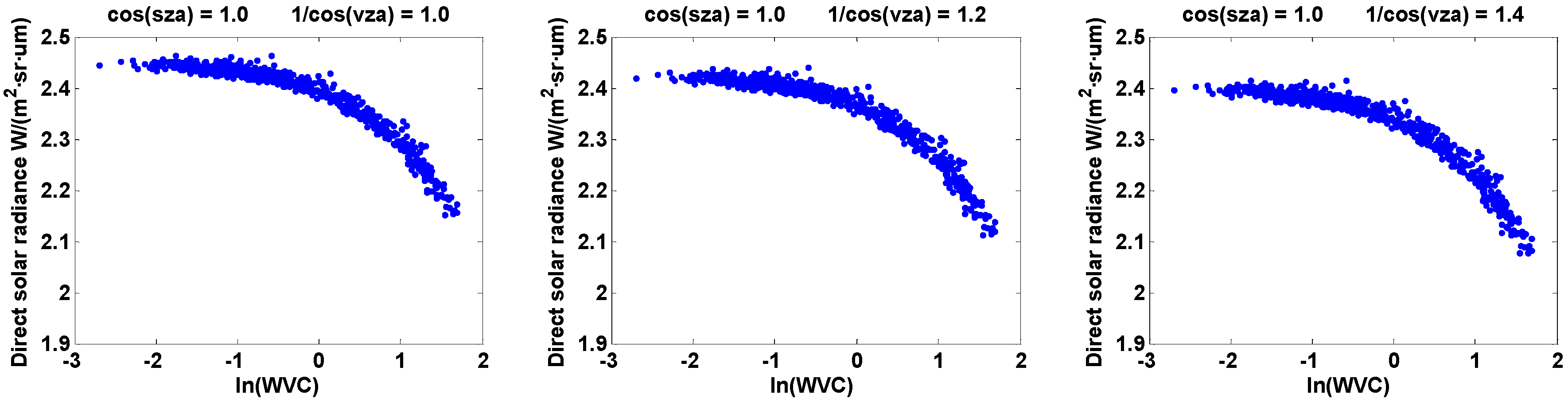
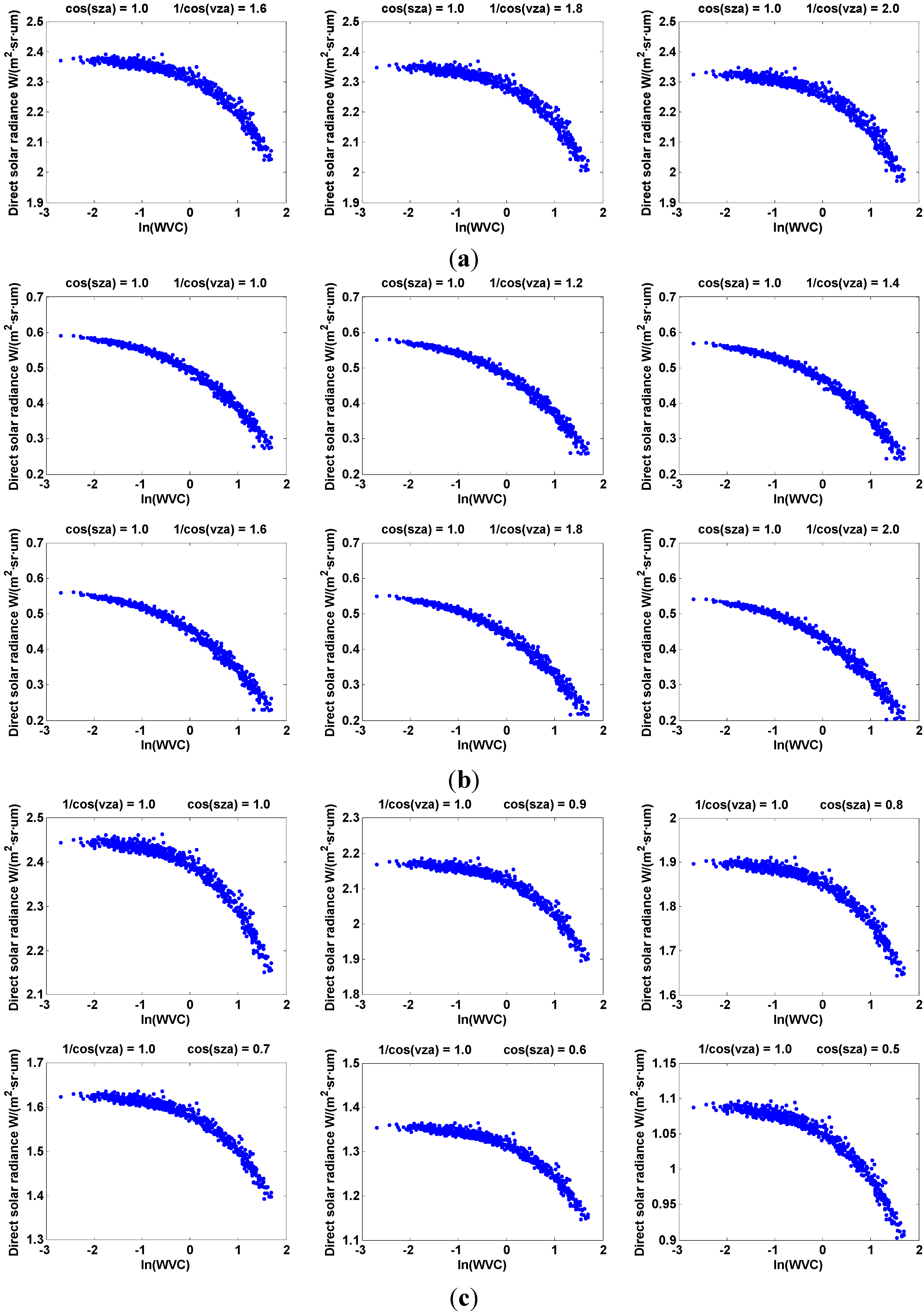
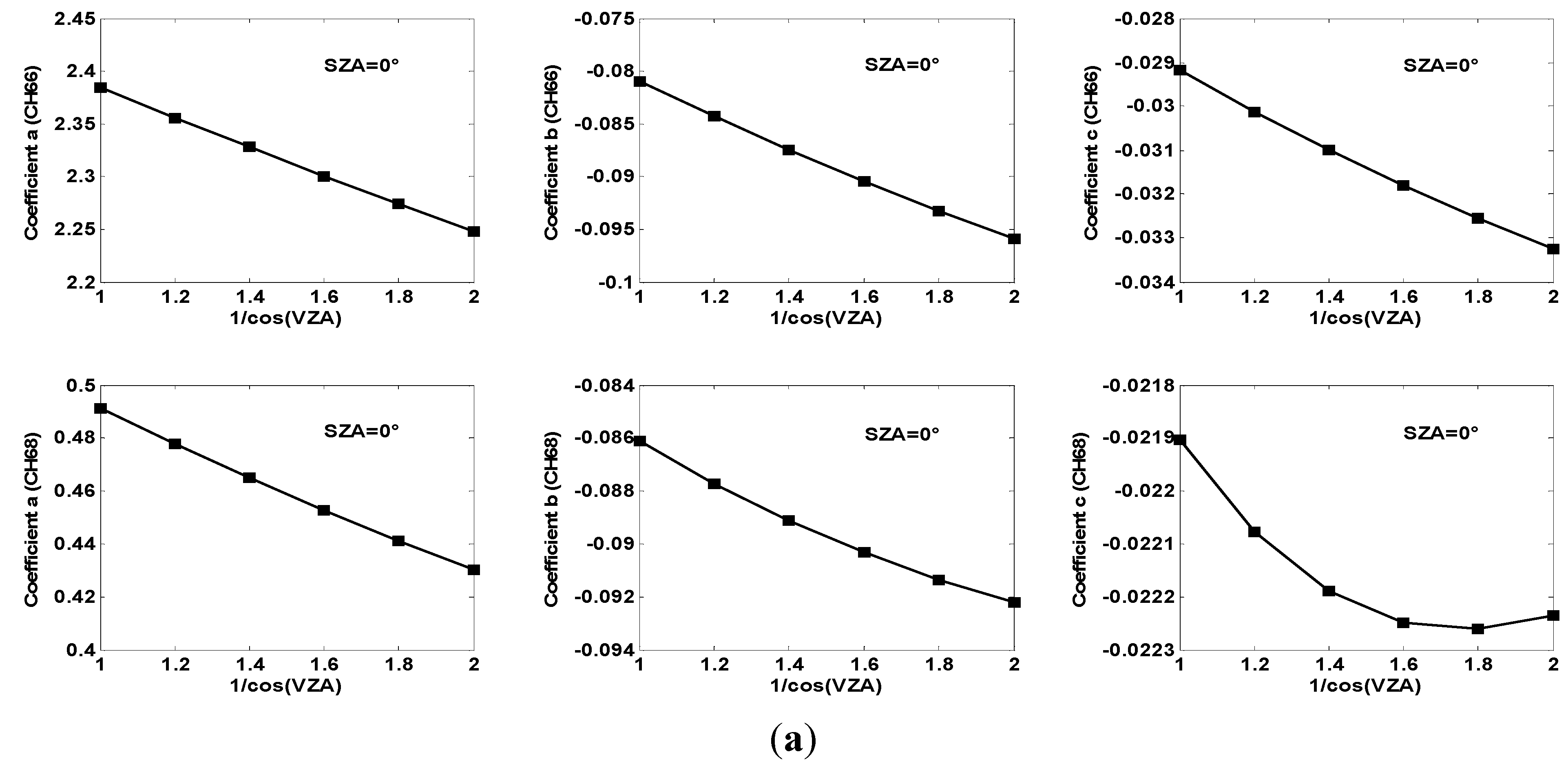
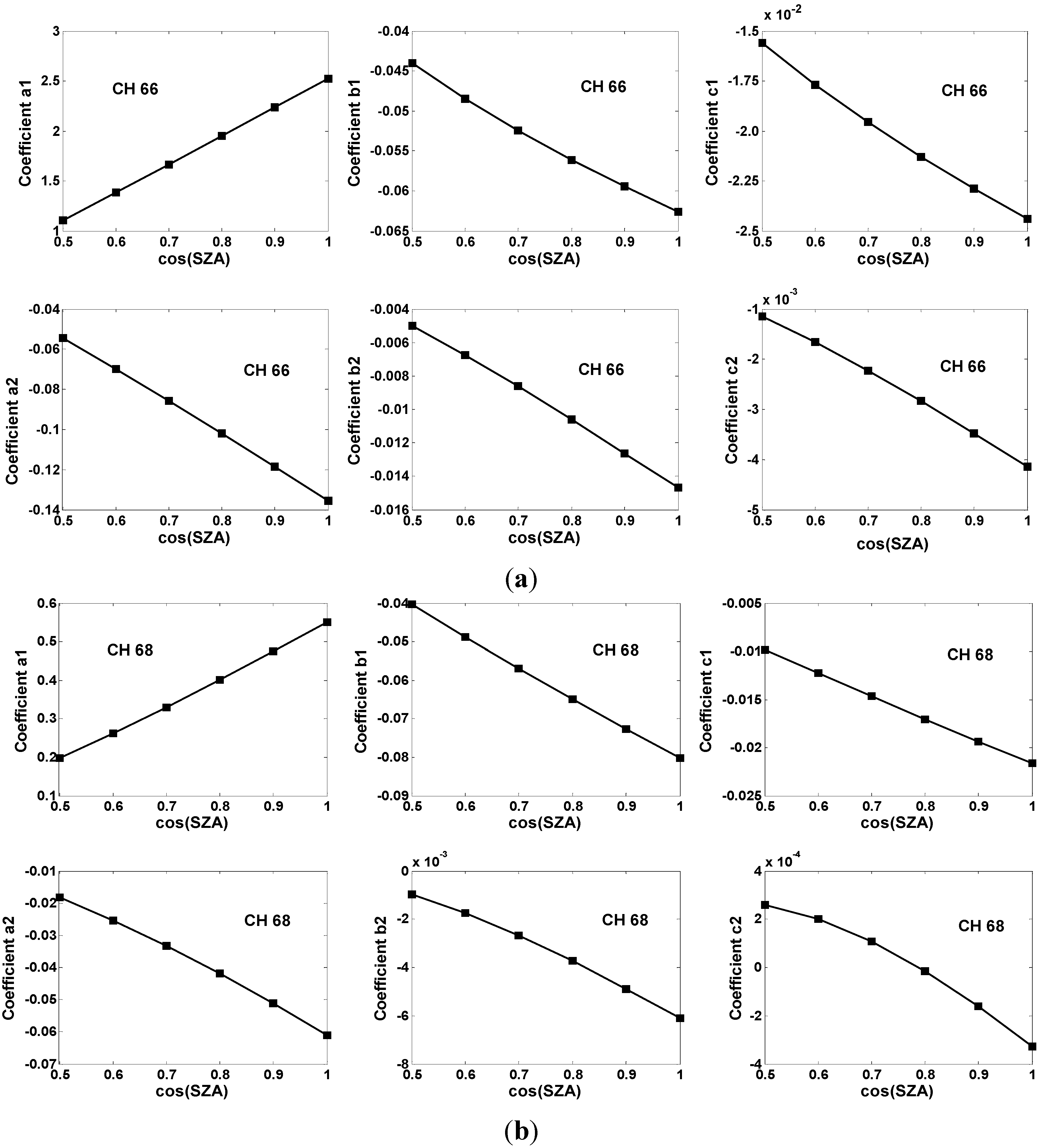
2.3.1. Estimation of Direct Solar Radiance
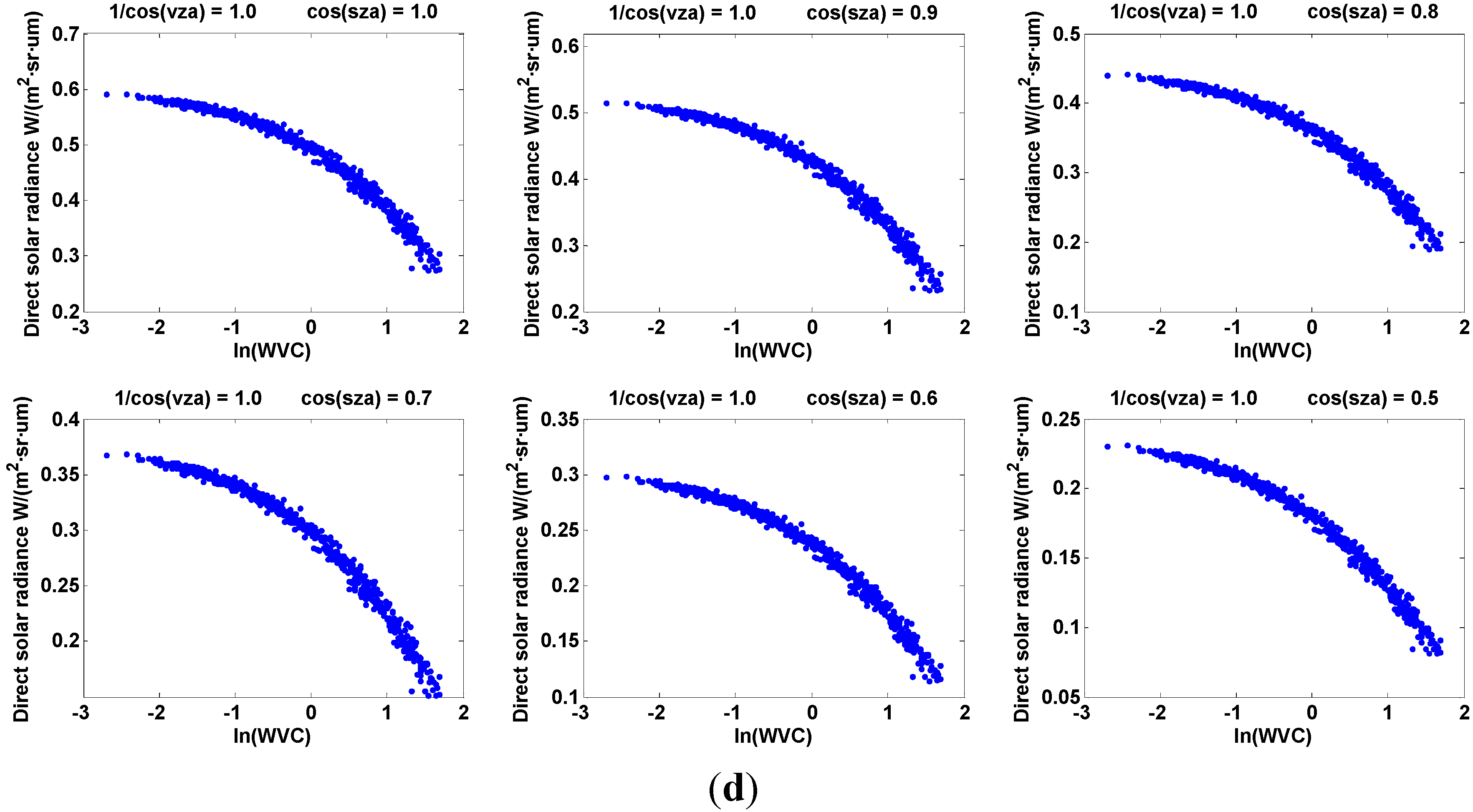
Relationship between Direct Solar Radiance and WVC


Direct Solar Radiance at Different VZAs


Direct Solar Radiance at Different SZAs
2.3.2. Estimation of LST

3. Results and Analysis
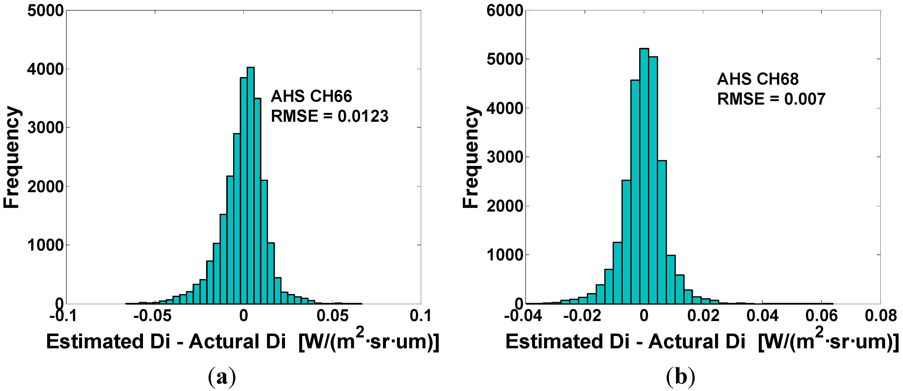
3.1. Estimated Result of Direct Solar Radiance

| Channel Coefficient | a11 | a10 | a21 | a20 | b11 | b10 | b21 | b20 | c11 | c10 | c21 | c20 |
|---|---|---|---|---|---|---|---|---|---|---|---|---|
| AHS CH66 | 2.849 | −0.325 | −0.162 | 0.028 | −0.037 | −0.026 | −0.020 | 0.005 | −0.018 | −0.007 | −0.006 | 0.002 |
| AHS CH68 | 0.709 | −0.163 | −0.086 | 0.026 | −0.080 | −0.001 | −0.010 | 0.004 | −0.024 | 0.002 | −0.001 | 0.001 |

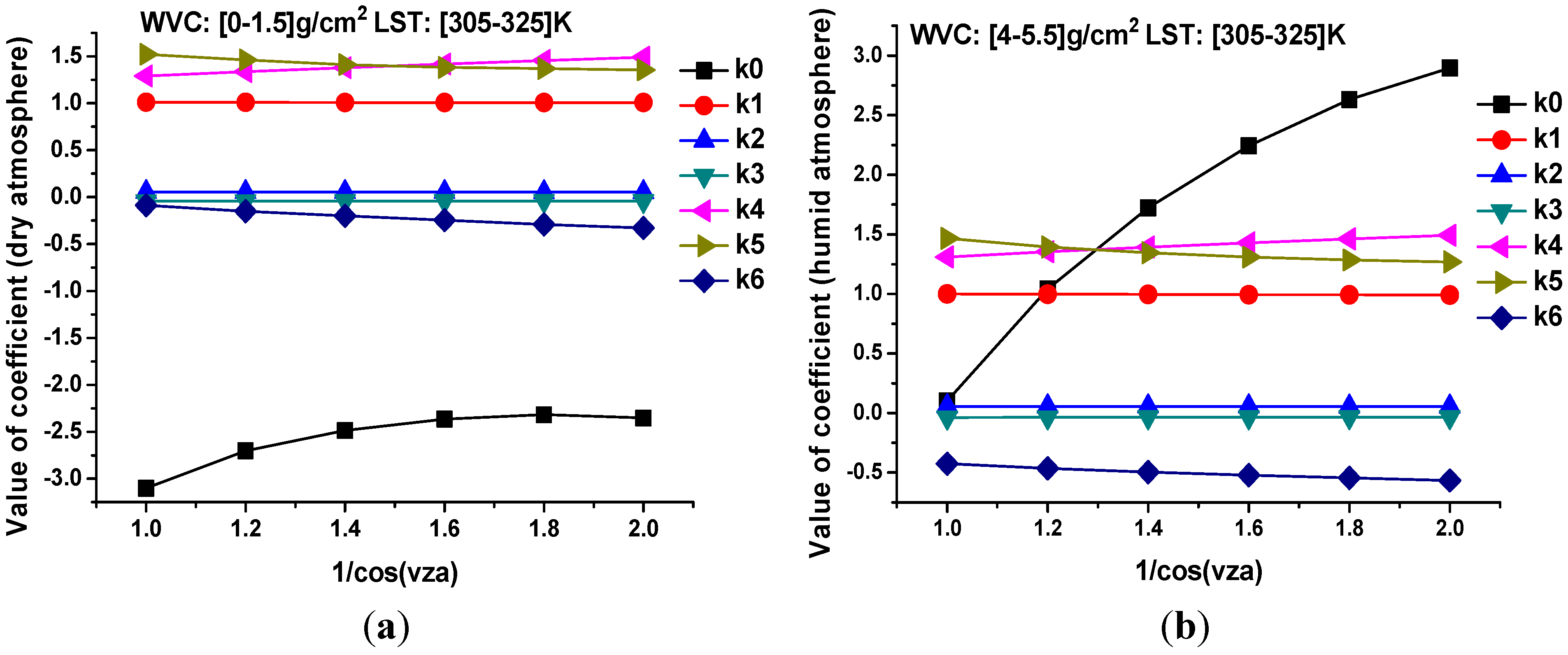
3.2. Coefficients of LST Retrieval Method

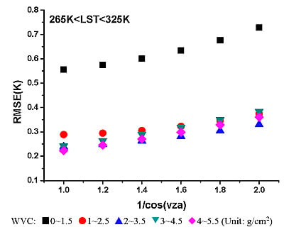
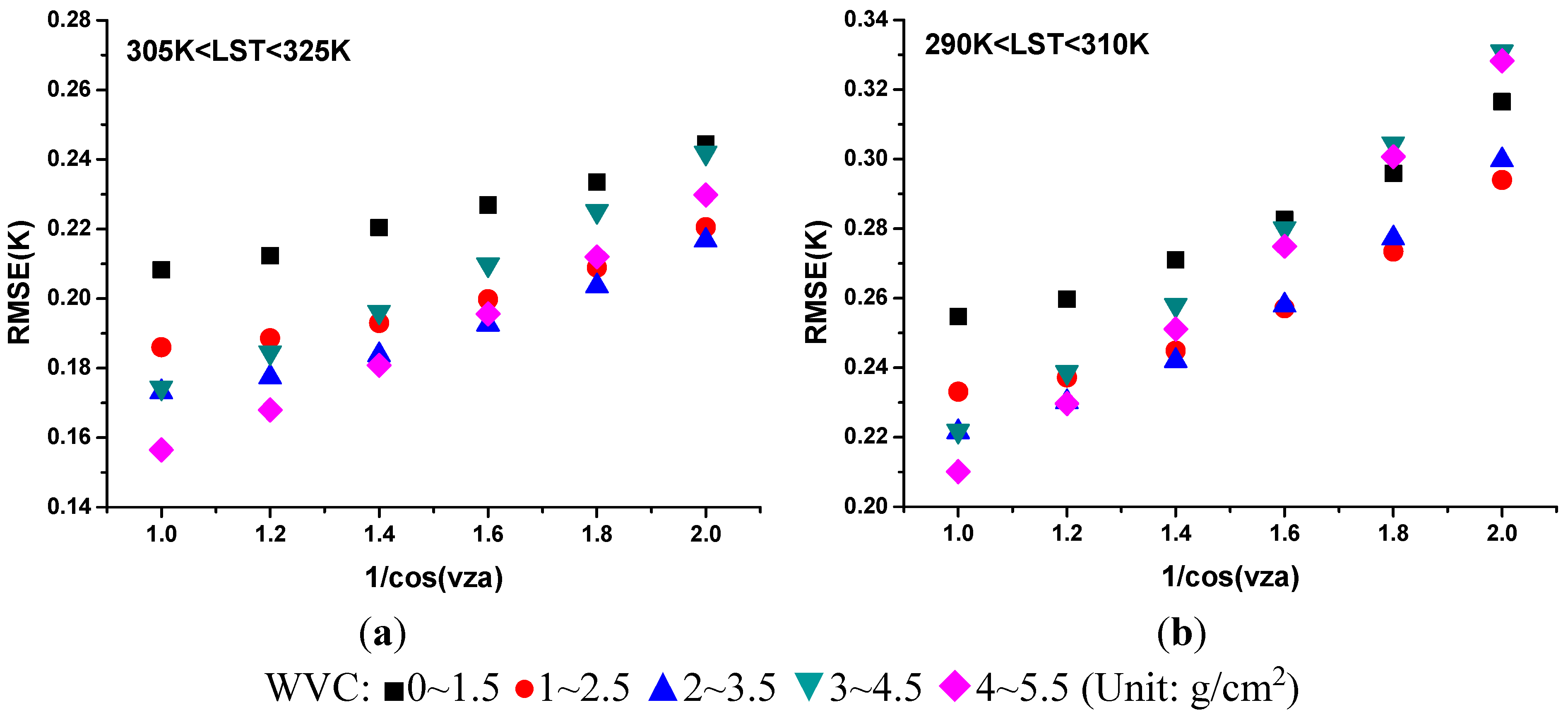
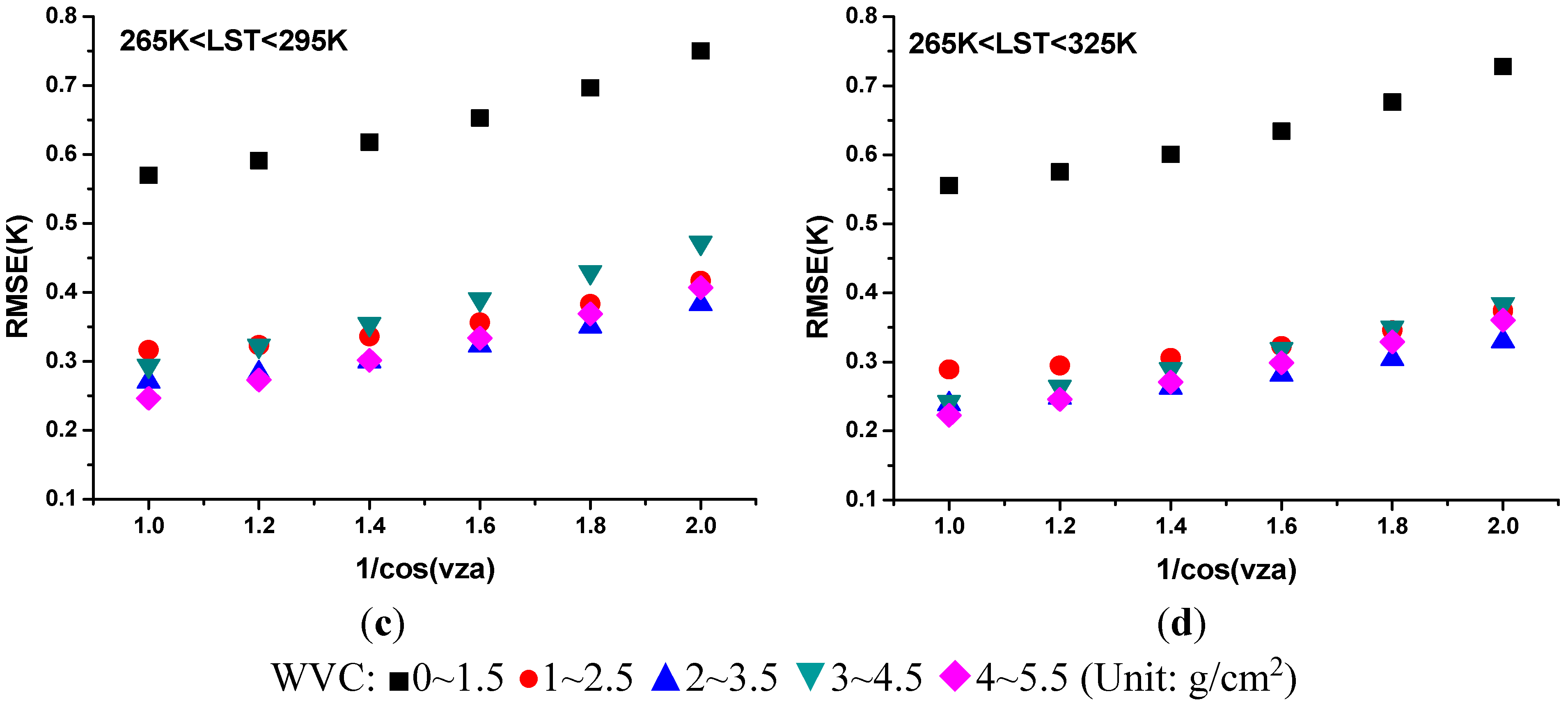
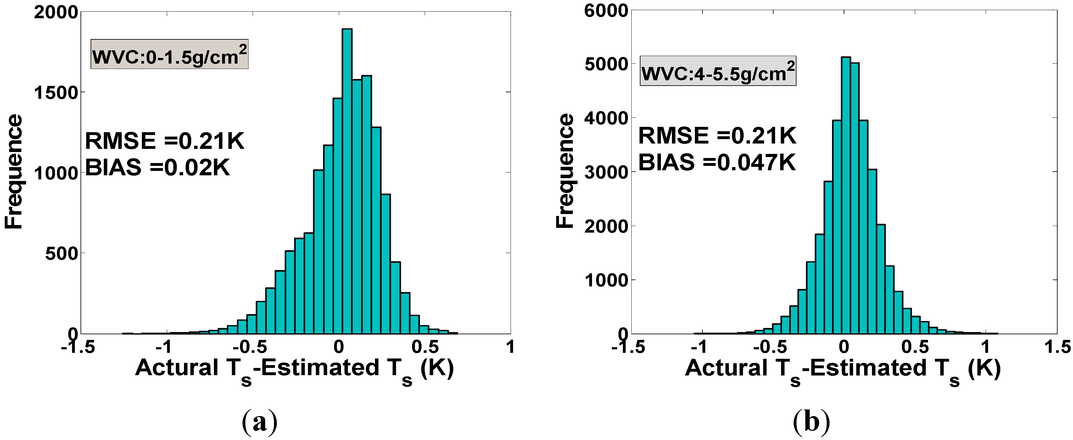
3.3. Result of LST Retrieval


4. Sensitivity Analysis
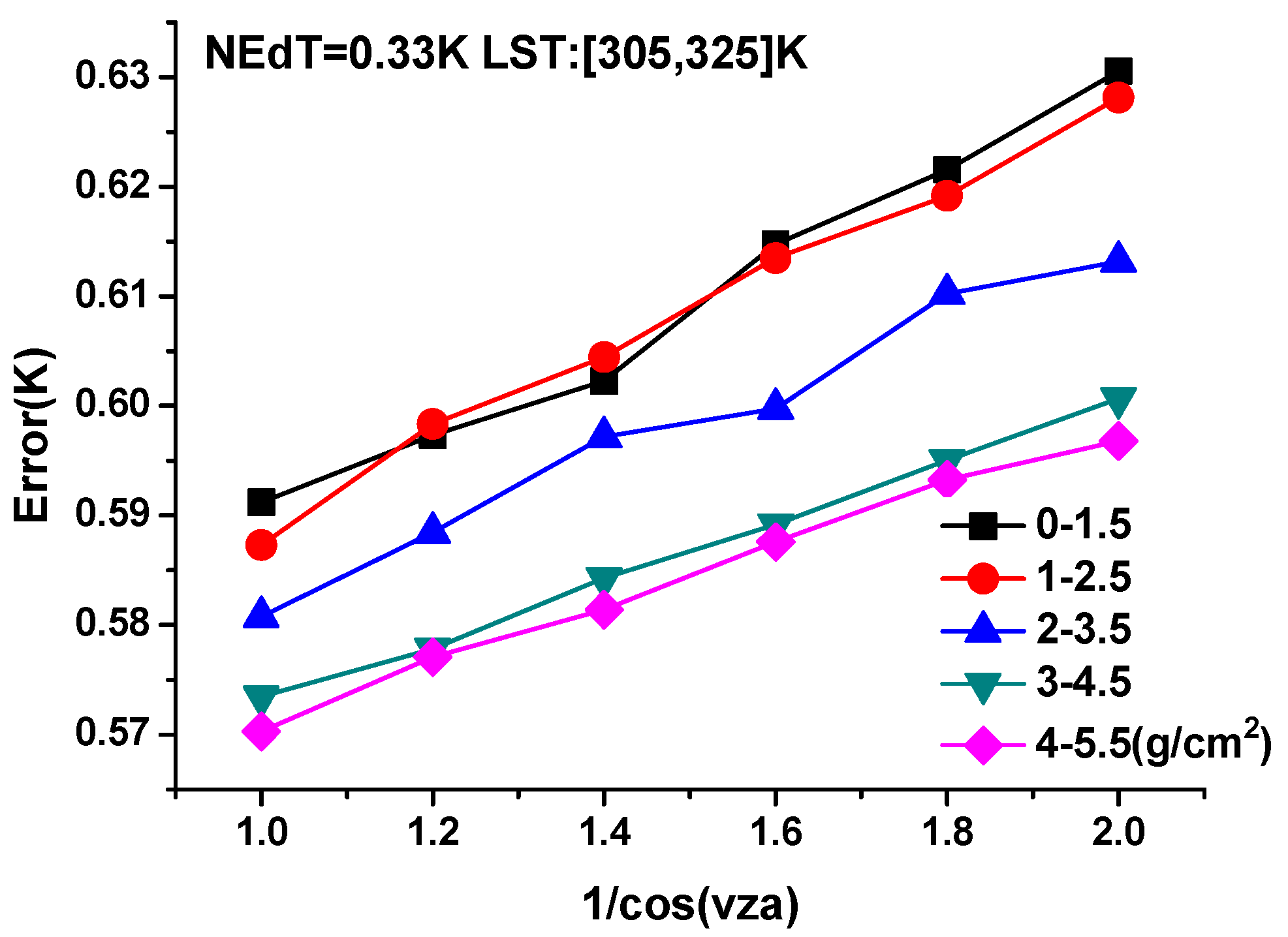
4.1. Sensitivity Analysis to Instrumental Noises

4.2. Sensitivity Analysis to LSEs
| WVC (g/cm2) | 305~325 (K) Error | 290~310 (K) Error | 265~295 (K) Error | 265~325 (K) Error |
|---|---|---|---|---|
| 0~1.5 | 0.50 | 1.04 | 2.83 | 2.71 |
| 1~2.5 | 0.49 | 0.94 | 1.68 | 1.31 |
| 2~3.5 | 0.44 | 0.84 | 1.37 | 0.92 |
| 3~4.5 | 0.40 | 0.76 | 1.40 | 0.81 |
| 4~5.5 | 0.40 | 0.74 | 1.26 | 0.73 |
4.3. Sensitivity Analysis to WVC


5. Preliminary Application to AHS data
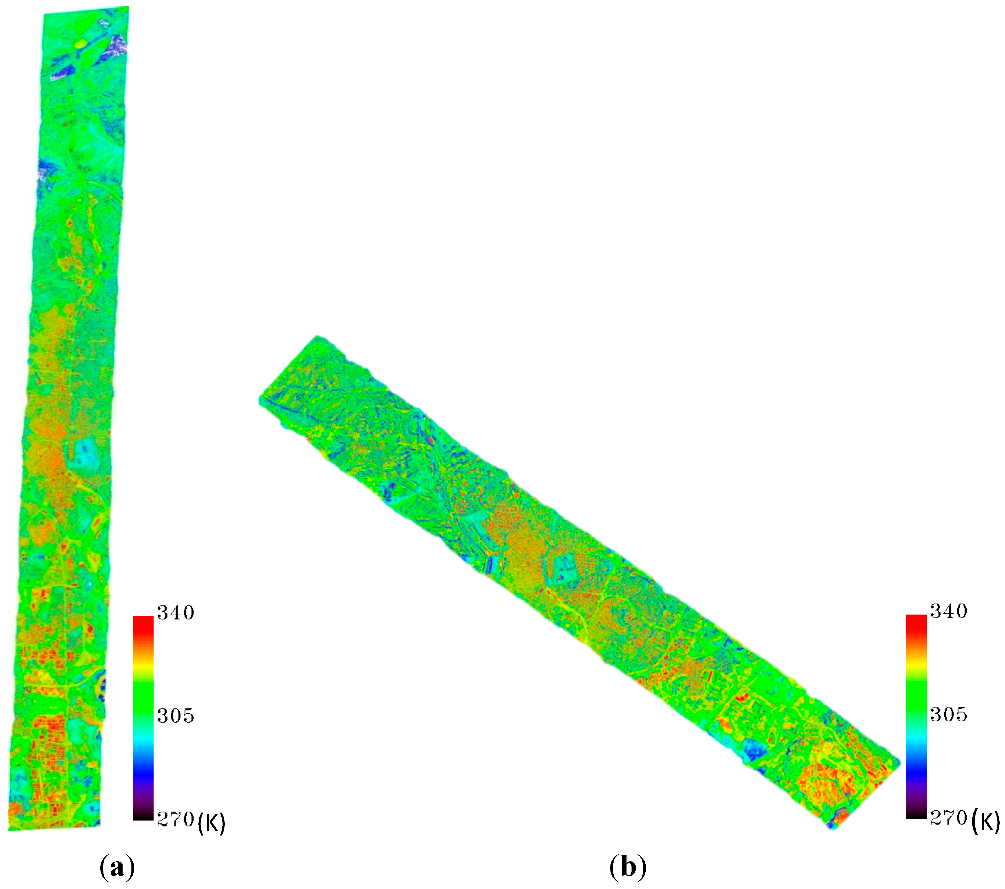
5.1. Data Processing
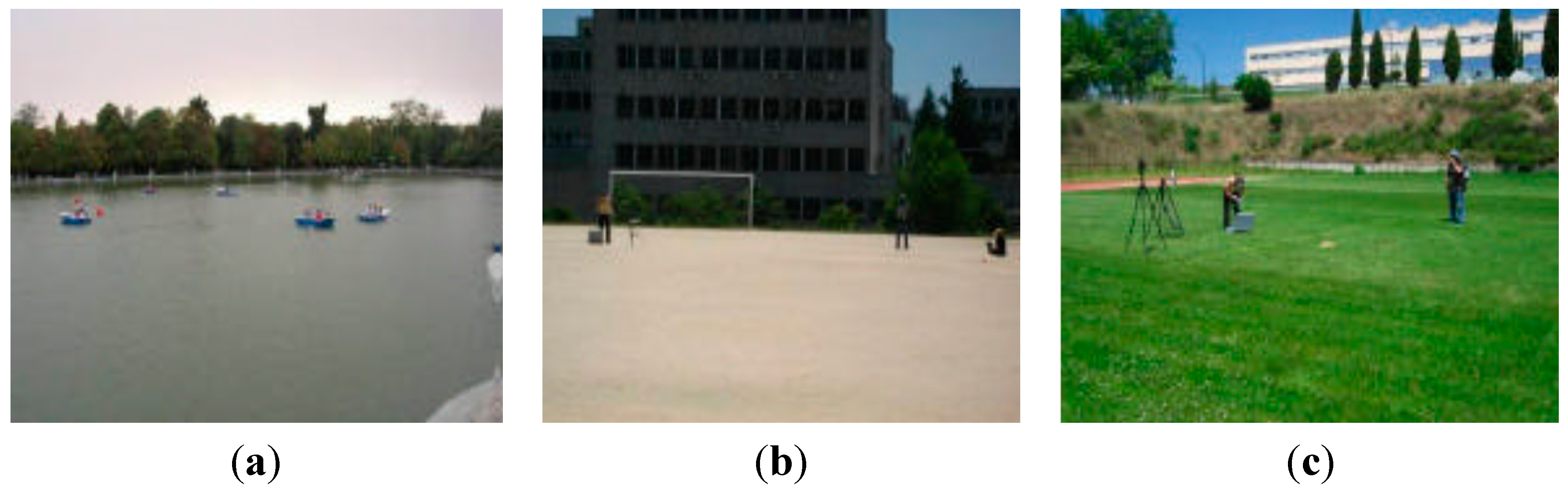
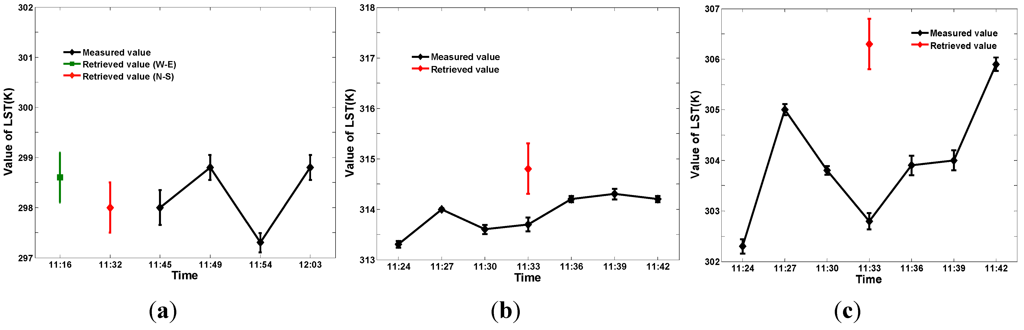
5.2. Results and Validation
| Instrument | Spectral Range (um) | Temperature Range (°C) | Accuracy (K) | Resolution | FOV |
|---|---|---|---|---|---|
| Cimel CE312-1 | 8~13 | −80 to 50 | 0.1 | 8 mK | 10° |
| 11.5~12.5 | 50 mK | ||||
| 10.5~11.5 | 50 mK | ||||
| 8.2~9.2 | 50 mK | ||||
| Cimel CE312-2 | 8~13 | −80 to 60 | 0.1 | 8 mK | 10° |
| 11~11.7 | 50 mK | ||||
| 10.3~11 | 50 mK | ||||
| 8.9~9.3 | 50 mK | ||||
| 8.5~8.9 | 50 mK | ||||
| 8.1~8.5 | 50 mK | ||||
| Heitronics KT19 | 9.6~11.5 | −50 to 200 | 0.1 | 0.05 K | 2° |
| NEC TH9100 | 8~14 | −40 to 120 | 2 | 0.1 K (320 × 240) | 22° × 16° |


| Coordinate | Surface Type | LSE | Retrieved LST | In situ Measurement | In situ Bias | |
|---|---|---|---|---|---|---|
| ε66 | ε68 | |||||
| 40°25′1.65″N, 3°41′2.65″W | Water | 0.976 | 0.979 | 297.6K | 298.3K | 0.3K |
| 40°32′52.44″N, 3°41′48.45″W | Bare soil | 0.769 | 0.799 | 314.8K | 313.9K | 0.6K |
| 40°32′51.71″N, 3°41′54.33″W | Grass | 0.984 | 0.987 | 306.3K | 304.0K | 2K |

6. Conclusions
Acknowledgments
Author Contributions
© 2014 by the authors; licensee MDPI, Basel, Switzerland. This article is an open access article distributed under the terms and conditions of the Creative Commons Attribution license (http://creativecommons.org/licenses/by/3.0/).
Share and Cite
Zhao, E.; Qian, Y.; Gao, C.; Huo, H.; Jiang, X.; Kong, X. Land Surface Temperature Retrieval Using Airborne Hyperspectral Scanner Daytime Mid-Infrared Data. Remote Sens. 2014, 6, 12667-12685. https://doi.org/10.3390/rs61212667
Zhao E, Qian Y, Gao C, Huo H, Jiang X, Kong X. Land Surface Temperature Retrieval Using Airborne Hyperspectral Scanner Daytime Mid-Infrared Data. Remote Sensing. 2014; 6(12):12667-12685. https://doi.org/10.3390/rs61212667
Chicago/Turabian StyleZhao, Enyu, Yonggang Qian, Caixia Gao, Hongyuan Huo, **aoguang Jiang, and **angsheng Kong. 2014. "Land Surface Temperature Retrieval Using Airborne Hyperspectral Scanner Daytime Mid-Infrared Data" Remote Sensing 6, no. 12: 12667-12685. https://doi.org/10.3390/rs61212667